Hit and miss week ahead
Monday, 4 May 2020
Hit and miss week ahead
Monday, 4 May 2020
Smaller swells with stronger winds developing, though there are a few windows to pick the eyes out of.
Smaller swells with stronger winds developing, though there are a few windows to pick the eyes out of.
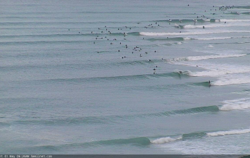
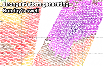
Sunday is a dynamic day for surf. More in the Forecaster Notes.
Make the most of the coming swell as beyond the outlook is quiet.
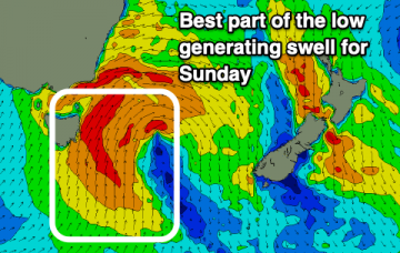
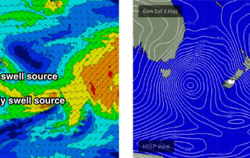
The Long Wave Trough currently responsible for cold weather, gale force winds and cold temps won’t push into our south swell window until Saturday morning. More in the Forecaster Notes.
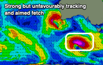
Developing large surf with onshore winds for the weekend, easing next week.
Not ideal conditions over the coming days with large groundswells, but winds from the northern quadrant.
A continuation of poor and windy, large surf tomorrow, with a better groundswell for Sunday as winds slowly abate.
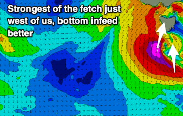
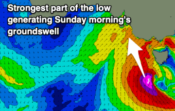
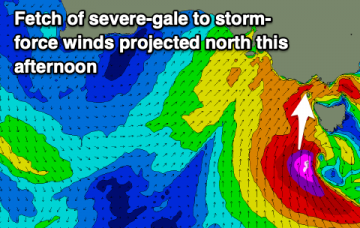
A deep and cold low will project its final and strongest arm up and into us this evening, bringing large, windy and stormy surf.
Nice to see both swell windows active. More in the Forecaster Notes.
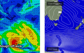
As mentioned above (and as also commented on in Wednesday’s notes) the models have stalled the west-east progression of the Long Wave Trough. More in the Forecaster Notes.