Poor end to the week, fun Saturday
Wednesday, 13 July 2022
Poor end to the week, fun Saturday
Wednesday, 13 July 2022
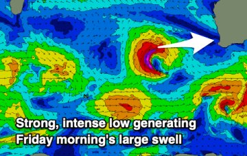
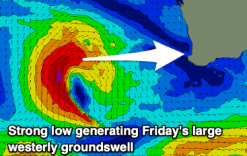
Increasing onshore winds and with strength along with a large swell. Cleaning up as it eases on the weekend.
Increasing onshore winds and with strength along with a large swell. Cleaning up as it eases on the weekend.
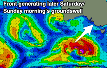
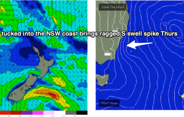
A trough line moving north-wards along the NSW Coast is spawning a surface low pressure system today, with the pressure gradient between the low and a high advancing through the interior creating a stiff S’ly flow along the coast.
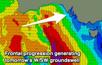
A mix of west and south-west energy over the coming days with light winds, increasing on the weekend.
A run of smaller swells with improving conditions over the coming days.
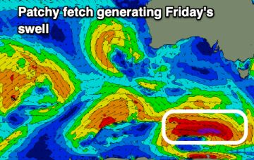
Fading east swell with not much to follow up until later week.
Lots to choose from this period with varying winds and swell pulses.
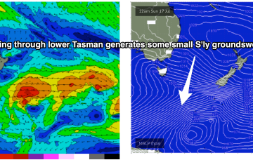
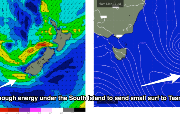
The remnants of the Tasman Low (ex ECL) are now drifting near the South Island, on top of a large high which is slowly moving out of the Tasman Sea. A high is approaching from the South Australian interior, with a trough expected to form off the coast later Tues and develop a broad, relatively weak low in the Central/Northern Tasman.
The remnants of the Tasman Low (ex ECL) are now drifting near the South Island, on top of a large high which is slowly moving out of the Tasman Sea. A high is approaching from the South Australian interior, with a trough expected to form off the coast later Tues and develop a broad, relatively weak low in the Central/Northern Tasman.
A new westerly swell with cleaner conditions is expected on the Mid Coast tomorrow, with options down South.
The remnants of the Tasman Low (ex ECL) are now drifting near the South Island, on top of a large high which is slowly moving out of the Tasman Sea. A high is approaching from the South Australian interior, with a trough expected to form off the coast later Tues and develop a broad, relatively weak low in the Central/Northern Tasman.