Generally small surf
Friday, 16 February 2024
Generally small surf
Friday, 16 February 2024
The coming days look generally small with a couple of clean, morning windows.
The coming days look generally small with a couple of clean, morning windows.
E’ly winds continue into next week, through this period and in fact most of next week we’ll continue to see pulsey E’ly swells coming off the deep E’ly fetch.
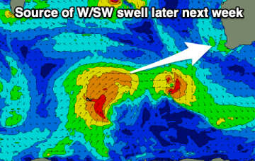
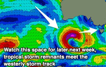
This afternoon's groundswell will ease into the weekend, with some small swell for early next week. Later next week looks a bit better.
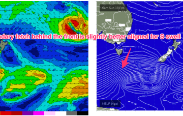
A long, broad E’ly tradewind fetch extends from the Coral Sea into the South Pacific with the tail of the fetch in Tahitian longitudes. To the south a complex low and front is expected to pass under the state over the weekend.
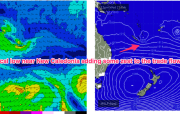
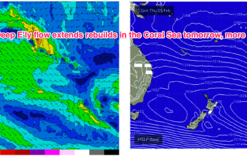
High pressure belt remains strong with cells lined up to enter the Tasman. A monsoonal low in the Gulf of Carpenteria is generating a long cloud band down the east coast. A long, broad E’ly tradewind fetch extends from the Coral Sea into the South Pacific with the tail of the fetch in Tahitian longitudes.
High pressure belt remains strong with cells lined up to enter the Tasman. A monsoonal low in the Gulf of Carpenteria is generating a long cloud band down the east coast. A long, broad E’ly tradewind fetch extends from the Coral Sea into the South Pacific with the tail of the fetch in Tahitian longitudes.
No real strong offshore wind is due this period, though variable tending light offshore breezes should create generally clean faces with some fun swell.
Make the most of the light winds this morning as the rest of the period is more miss than hit.
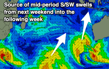
A bit more swell potential from next weekend.
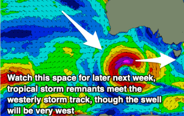
Multiple cells of reinforcing high pressure then one by one move into the Tasman, maintaining a weak ridge up the NSW Coast and a deep E’ly flow through the South Pacific and Eastern Coral Sea, with resulting E’ly swells favouring the sub-tropics for size, with a rebuild in size expected later this week.