Fun weekend, very dynamic outlook next week
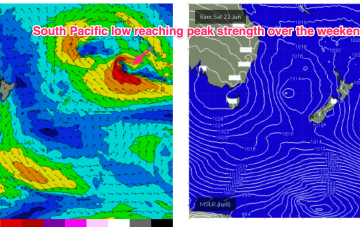
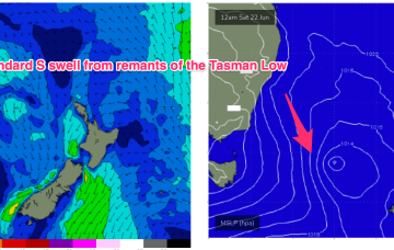
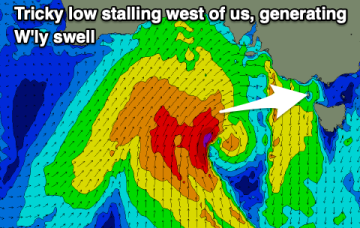
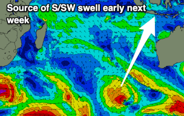
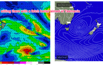
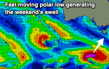
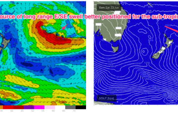
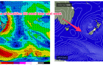
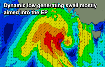
The current swell will ease on the weekend with a fun swell for the South Coast, while next week is very dynamic with a large, local swell due.
The system reaches peak strength over the weekend in Tongan longitudes, with a long fetch of E'ly winds, but it is moving away as it deepens, which limits swell growth.
S’lies in the a’noon are expected to exceed 20 knots with gusts possible to 30 knots so the a’noon will be windy and mostly blown out. Short period S swell will rise as a result but keep expectations low.
The weekend looks mixed with Sunday performing best, while next week is tricky with some new west swell due but to what size is unknown right now.
Good S/SW groundswell for the coming days with plenty of trade-swell in the Maldives.
Models are also suggesting a deep sub-tropical low in Tongan longitudes right on the edge of the swell window (see below), which looks to supply some long period E/SE swell through Wed into Fri.
Winds feeding into the southern flank of the low are well aimed at Tasmania and we’ll see more strong SE tending E/SE swell tomorrow.
Next week looks very slow so make the most of the current E/SE swell and new SW swell spike for the weekend.
995 hPa low still sitting in the Central Tasman, but the supporting high pressure cell has slipped in underneath the low and as a result we’re seeing a slowly diminishing fetch and easing pressure gradients both in the Tasman and along the coastal fringe.