Poor run of surf continues
Thursday, 29 December 2016
Poor run of surf continues
Thursday, 29 December 2016
No end in site to the average run of swell across all regions this coming fortnight.
No end in site to the average run of swell across all regions this coming fortnight.
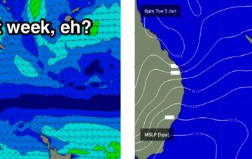
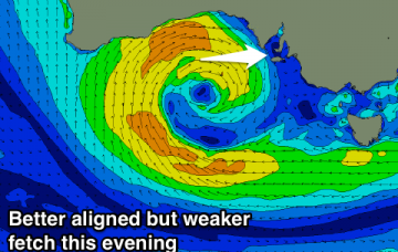
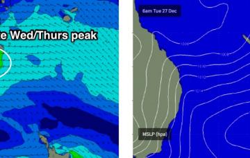
A broad fetch of easterly winds through the lower Coral Sea associated with a Tasman high and a small tropical depression are generating an easterly swell that’s expected to reach a peak on Thursday, before easing into Friday.
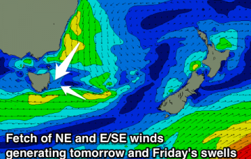
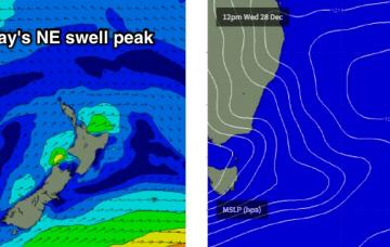
Good NE swell for tomorrow with favourable winds for north facing spots. Afternoon increase in E/SE swell, peaking Friday morning with light winds.
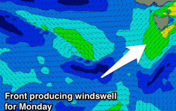
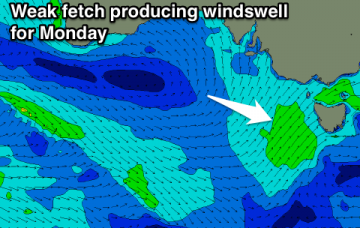
No major swells besides an increase in SW windswell Monday.
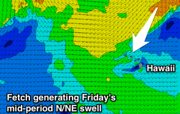
Easing surf tomorrow with workable winds, new inconsistent swell building Friday, peaking Saturday with similar winds, cleaner and easing Sunday.
The strongest phase of this setup will occur overnight tonight so Thursday morning will consequently see the largest surf.
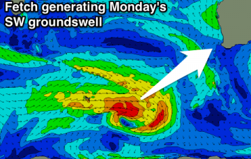
Building W'ly swell tomorrow afternoon with increasing NW winds. Swell peaking Friday with easing W/NW tending W/SW winds. Clean easing swell Saturday. No size for the South Coast until Sunday but with an onshore wind.
Tiny tomorrow and Friday morning, onshore and a touch bigger into the afternoon. Fading swell Saturday and average winds for the Mornington Peninsula. Inconsistent W/SW swell for Sunday with a morning W/NW breeze.
Building NW swell tomorrow afternoon, easing Wednesday. Funky N/NE swells from Friday with average winds. Nothing long term.
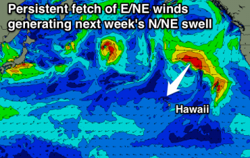
We’re looking at a slow increase in size over the coming days towards a plateau in and around very late Wednesday through Thursday.