Points, points, points from Wednesday onwards
Monday, 19 March 2018
Points, points, points from Wednesday onwards
Monday, 19 March 2018
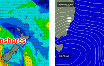
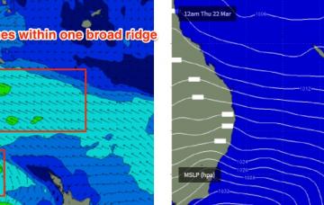
We’ve got an extended period of onshore winds coming up.
We’ve got an extended period of onshore winds coming up.
Most of this week looks horribly onshore.
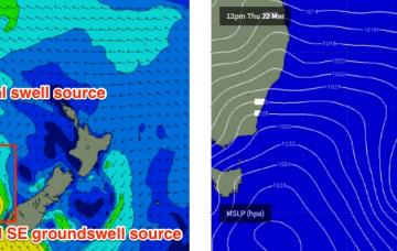
New large SW groundswell tomorrow but with SE-S/SE winds, favouring the Mid Coast. Clean easing Mid Coast waves Wednesday, better down South Thursday and Friday. Clean fading surf over the weekend ahead of a SW change.
Very large SW groundswell for tomorrow but with poor winds, easing Wednesday as poor winds persist. Cleaner across the beaches into Thursday and Friday with a new SW groundswell later in the week.
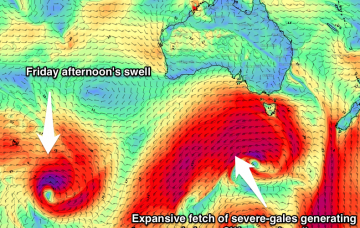
Our swell combo originating from ex-TC Linda will continue to fall away steadily into the weekend, however there’s new energy inbound from two sources.
The new long period swell modeled to arrive later today should push through overnight and provide a full day of inconsistent, flukey south swell into Saturday.
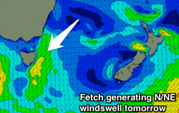
Easing S'ly groundswell and N/NE windswell tomorrow with N/NW winds. Strengthening offshore winds Sunday with a small easing N/NE windswell. Nothing special until possibly later next week.
Easing S/SW swell tomorrow with offshore winds, with a building W'ly swell later Monday, large from the W/SW Tuesday and easing from the SW Wednesday.
Onshore building windswell tomorrow with a better groundswell and offshore winds Sunday morning. Clean conditions most mornings next week with smaller surf, with some possible cyclone swell next weekend.
Clean easing S/SW swell tomorrow morning with good winds early, onshore stormy swell developing Sunday, becoming larger Monday with good winds for the South Coast, very large and onshore Tuesday/Wednesday.