Wild week of wind, rain and swell ahead
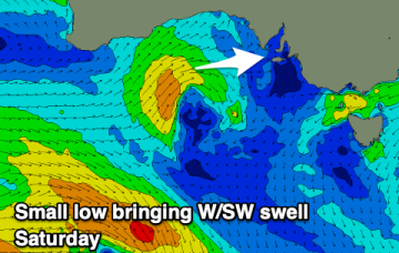
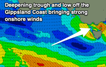
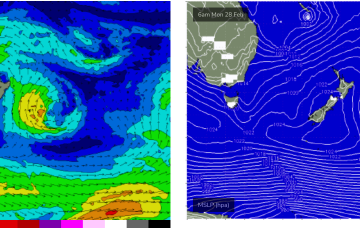
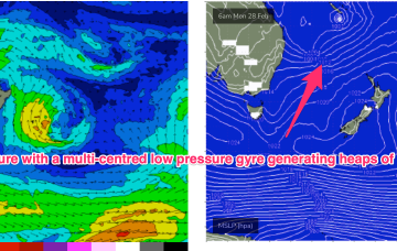
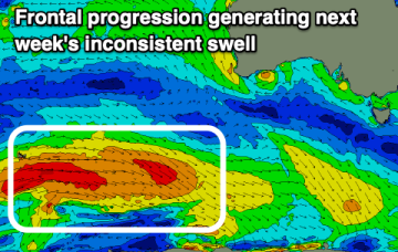
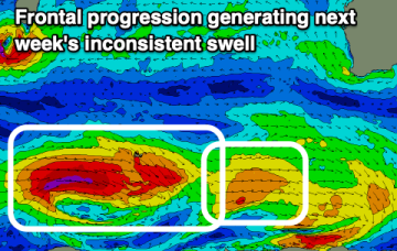
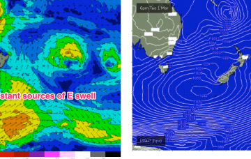
This is maintaining a deep E’ly flow, with coastal troughs and a surface low off the NSW North Coast, now moving South.
Another so, so period but there'll be some fun windows of cleaner conditions across the South Coast into the end of the week.
Peaky and relatively clean conditions on the beaches all week with poor surf developing from the weekend.
During next week a static pattern develops where strong high pressure is positioned far enough south for a strong, deep E’ly flow to impact Tasmania.
Unfortunately, the low now moves southwards, dragging the E’ly flow with it, out of the CQ swell window.
The basic building blocks of the pattern are a strong high pressure belt cradling multiple low pressure systems in the Coral Sea and South Pacific- essentially creating a huge, multi-centred low pressure gyre through a vast area of ocean to our east.
A slightly tricky period and not ideal for Clifton. Other options are likely better.
Lots of action next week. We’ve got a stack of strong E to E/NE swell incoming- with some model variability suggesting we’ll need some further fine tuning next week.
Fading surf on the weekend with increasing winds, windy and more onshore through mid-next week with some better swell. Better surf from next weekend.
The wind outlook is a little more promising for the coming period with some fun windows of surf for the South Coast.