Back to the small stuff
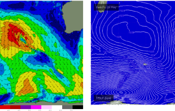
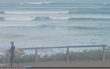
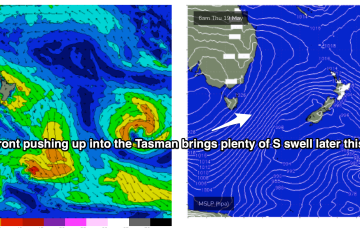
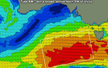
Now that we’re on the backside of this swell event, the outlook is somewhat academic, continuing down Thursday, then down even more Friday.
Plenty of S swell continues through Fri with SW winds remaining fresh and gusty.
OK, before we get to the outlook, it’d be good to touch base on a few things regarding the current swell event. Mainly around expectations, and where they should be positioned.
Following that an active tradewind pattern in the Coral Sea supplies another round of E swell for the region, with a trough of low pressure expected to form off the Capricorn Coast and energise further the E/SE winds off the CQ coast.
We’re going to see multiple overlapping pulses of S swell over the coming days as fronts slingshot around the parent low on an active sea state, with the biggest surf coming with some dodgy winds as the high pressure ridge sets up. Following that an active tradewind pattern in the Coral Sea supplies another round of E swell.
A series of cold fronts with embedded troughs are now steaming into the Tasman Sea, anchored by a deep polar low which provided large swells for Victoria and New Zealand’s West Coast.
Weekend looks pretty good, with moderate storm activity in the Central Indian Ocean sending another moderate W/SW swell towards WA.
Wave heights are trending steadily upwards at Cape du Couedic, which is a good sign - as opposed to a J-curve, which often denotes an event of shorter duration.
Stronger fronts push up into the Tasman from later Wed, bringing a SW flow and bigger S swell as we head to the end of the week.
So, here we are, on the cusp of a major winteresque swell (and weather) pattern.