Good weekend of waves
Wednesday, 22 June 2022
Good weekend of waves
Wednesday, 22 June 2022
Much better and more reliable levels of more consistent swell this weekend with favourable winds until Sunday afternoon.
Much better and more reliable levels of more consistent swell this weekend with favourable winds until Sunday afternoon.
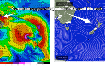
We’ve got a nice chunky 1033 hPa High slow moving at very southerly latitude, roughly triangulated between Tasmania and the South Island. As well as a precursor SE fetch adjacent to the South Island it is now squeezing pressure gradients with a compact, but deep low, which is currently forming gale force fetches out of Cook Strait and just north of the North Island. The Cook Strait fetch will produce some fun waves for East Tasmania.
The fetch is located on the edge of the CQ swell window so is likely to produce some E/SE groundswell at spots open to swell through the Capricorn Channel and north of the Breaksea Spit.
As well as a precursor SE fetch adjacent to the South Island it is now squeezing pressure gradients with a compact, but deep low, which is currently forming gale force fetches out of Cook Strait and just north of the North Island. Compared to Fridays model runs the fetch now is a little more mobile, weaker and rotates faster out of the swell producing phase, which will see a bit of a downgrade. Still some good waves on offer though.
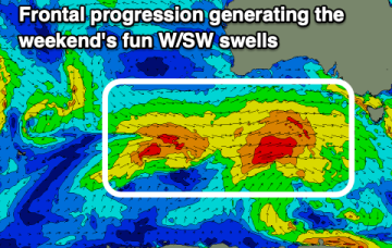
Nothing to recommend until late week when some new W/SW swell fills in.
We’ve got a nice chunky 1033 hPa High slow moving at very southerly latitude, roughly triangulated between Tasmania and the South Island. As well as a precursor SE fetch adjacent to the South Island it is now squeezing pressure gradients with a compact, but deep low, which is currently forming gale force fetches out of Cook Strait and just north of the North Island.
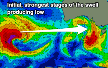
Average conditions over the coming days ahead of a large, powerful W/SW groundswell, cleanest as it eases.
A moderate sized westerly swell is due this afternoon and tomorrow, though onshore on the Mid. Larger swell energy is due later week.
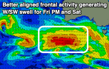
A few fun warm-up waves tomorrow ahead of some better swell energy into Friday afternoon and Saturday, cleanest in protected spots.
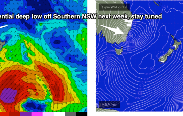
A broad region of troughiness stretching from the Tasman Sea through the Coral Sea over the weekend will coalesce into a major sub-tropical low off New Zealand’s North Island, on Monday.