East winds to dominate
Friday, 30 September 2022
East winds to dominate
Friday, 30 September 2022
We've got a run of east winds this period though Sunday morning looks to be the cleanest west of Melbourne with a new groundswell.
We've got a run of east winds this period though Sunday morning looks to be the cleanest west of Melbourne with a new groundswell.
We'll see poor winds and conditions through tomorrow, improving from Friday but cleanest on the weekend.
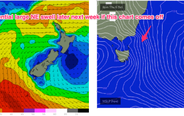
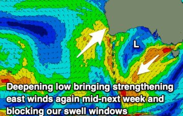
There’s still some model divergence to deal with but some model runs show gales developing in close proximity to the NE Tas coast. Under this scenario we will be looking at a serious NE swell event, for late next week.
We've got smaller swells on the cards for the coming period but with generally favourable winds in the mornings.
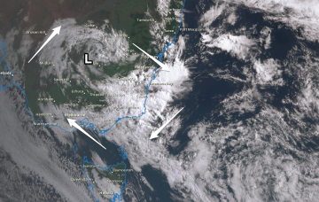
We are now on the cusp of a low pressure event as a complex inland trough of low pressure forms a new low off the Central NSW Coast, backed by an advancing strong high pressure cell.
We are now on the cusp of a low pressure event as a complex inland trough of low pressure forms a new low off the Central NSW Coast, backed by an advancing strong high pressure cell.
We'll see the fun run of waves on the Mid Coast fading through the end of the week, with onshore winds tending lighter and more offshore for the South Coast through the weekend.
Poor winds and plenty of swell for the coming days but only improving from Sunday and mostly for the beaches.
Good surf tomorrow with variable winds ahead of a trough and onshore surf for the rest of the week.
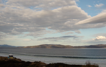
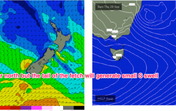
S’ly winds freshen through Thurs, tending SSE through the day as the low winds up and a large high moves towards Tasmania. Tasmania is right at the tail of the fetch (see below) but this should still be sufficient to whip up 2-3ft of S swell through the day.