Clean conditions with fun swells

Western Australia Surf Forecast by Craig Brokensha (issued Monday 24th April)
Best Days: Tuesday late morning before sea breezes, Wednesday morning, Thursday, Friday midday before sea breezes, Saturday morning, Sunday morning
Recap
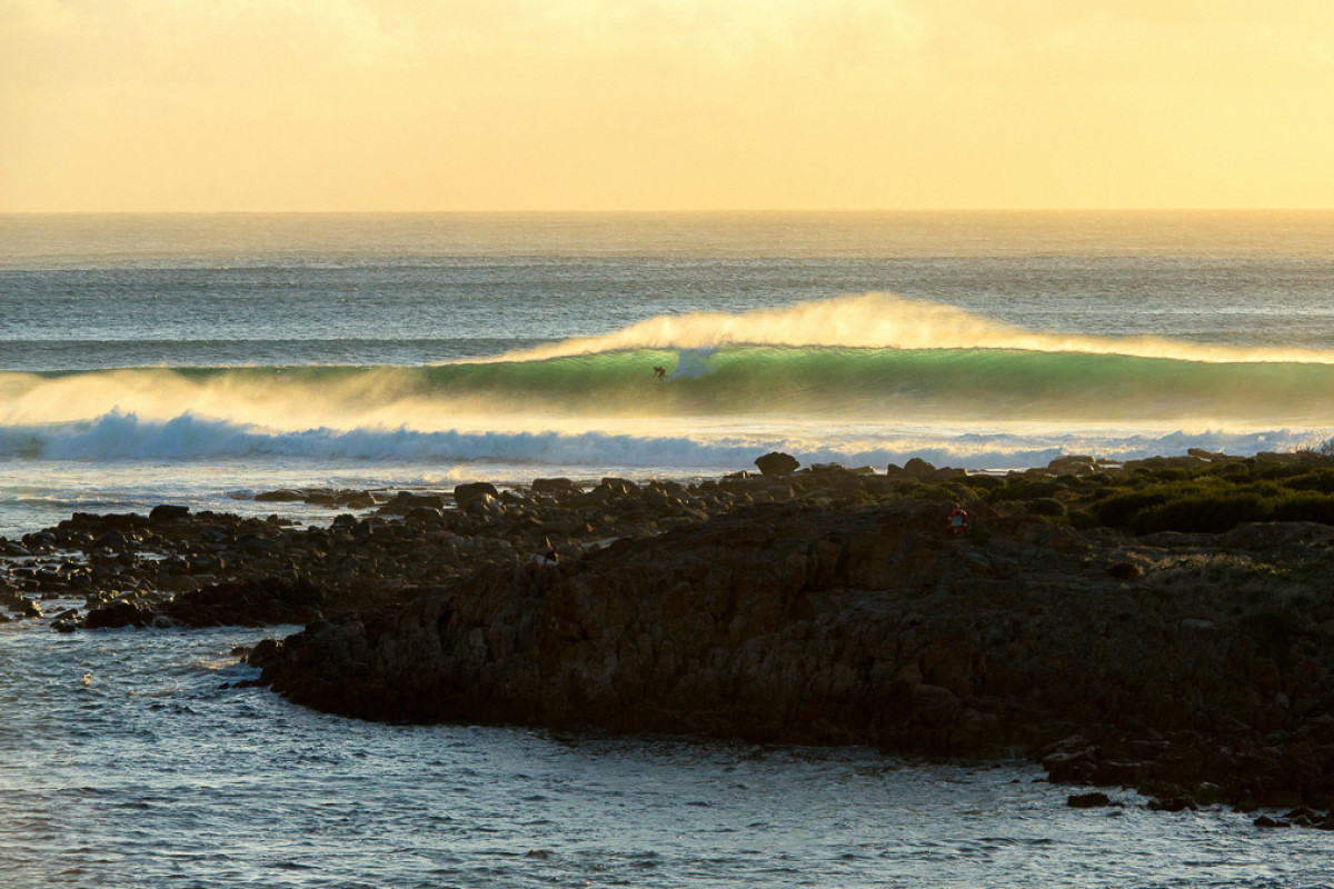
Protected spots fired on Saturday across the South West (as shown in our Wave of The Day shot by Peter Jovic) with a large building W/SW swell and S/SE winds. Mandurah saw clean 2-3ft sets, with inconsistent 2ft waves to the north.
Sunday was smaller and back to 4-5ft across the South West with 1-2ft waves around Mandurah and 1-1.5ft up in Perth.
Today the swell was even smaller, but conditions nice and clean across all locations.
This week and weekend (Mar 25 – 30)
Tomorrow morning should be smaller again with leftover 3ft sets across the South West along with clean conditions. A new SW groundswell is due to fill in through the day, peaking now into the afternoon before easing Wednesday.
This swell has been generated by a broad and at stages strong polar frontal progression over the weekend, and we should see sets kicking back to 4-5ft+ across the exposed reefs late morning/midday before easing back Wednesday from 3-5ft. Mandurah should see 1-2ft sets building at magnets, while Perth will remain tiny.
A window of clean conditions is due late morning/midday tomorrow before sea breezes kick in, then Wednesday looks great again with an E'ly offshore ahead of sea breezes.
A small reinforcing SW swell will slow the easing trend Thursday with 3-4ft sets across the South West (tiny to the north) and conditions look good most of the day with an E'ly tending variable breeze.
A low point in swell is due Friday morning with an E/SE offshore, but around midday, a new long-period and good SW groundswell should start to show.
This swell is starting to be created north of the Heard Island region by a vigorous low pressure system.
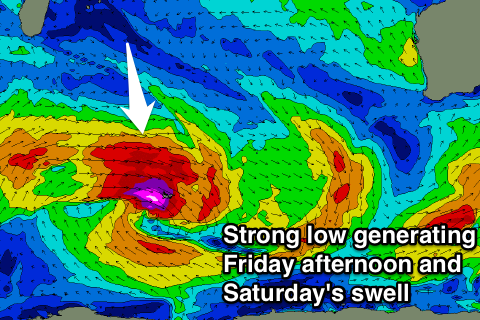 A pre-frontal fetch of severe-gale to storm-force W/NW winds are being generated, with the system due to track south-east through our swell window while maintaining its strength over the coming days.
The swell should kick to a strong 5-6ft into the afternoon across the South West (1-2ft Perth by dark) and hold a similar size Saturday morning, ease late and further Sunday.
Conditions are looking great each morning with straight and light to moderate offshore breezes (possibly tending E/NE) but we'll review this Wednesday.
Longer term there's plenty more moderate to large sized groundswell on the cards for early next week but winds look to tend more northerly. More on this in the next update.