Stormy XL swell for the weekend, onshores all next week

Western Australia Surf Forecast by Craig Brokensha (issued Friday 30th September)
Best Days: Novelty breaks later Saturday and Sunday, Perth possibly early Tuesday, and early Wednesday
Recap
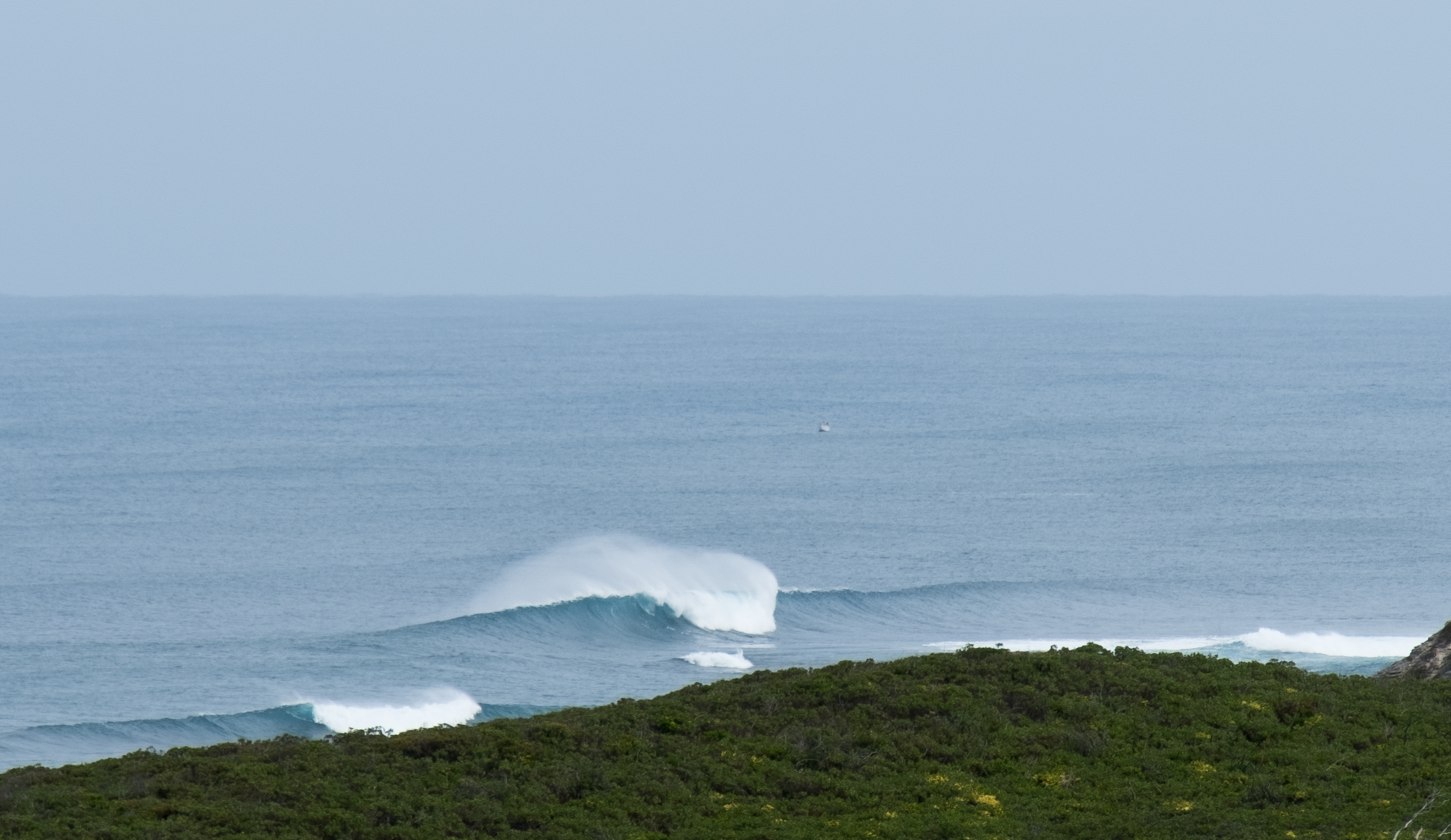
Have a look at the picture below and try and save it in the memory bank. It was from yesterday morning's small respite in onshore winds, with a clean 4-6ft of groundswell across the South West. Clean conditions aren't due again for as least the next 10 days.
Perth saw clean 2ft sets as well, but onshore winds kicked in through the afternoon.
This morning there's no decent groundswell about and onshore winds are creating poor conditions.
This weekend (Oct 1 - 2)
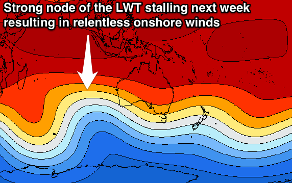
As touched on above, onshore winds will continue to plague the South West until at least Tuesday week, and Perth will also cop the onshore winds due to the high riding fronts. This will be due to a strong node of the Long Wave Trough currently moving across us followed by a secondary node stalling to our west all next week.
Firstly this weekend, and the swell has been upgraded a little for our regions, as a vigorous mid-latitude low currently moving in from the west will be overridden by a stronger front projecting a fetch of severe-gale W/SW winds into us tomorrow afternoon and evening.
This will help boost the already XL building swell to the 15ft+ range later tomorrow across the South West and 4-5ft in Perth.
Easing surf from 12-15ft is then due Sunday morning around Margs and 3-5ft in Perth.
Conditions will be a complete write-off though with strong to gale-force W'ly tending W/SW winds tomorrow and strong easing SW tending W/SW winds Sunday.
 Next week onwards (Oct 3 onwards)
The surf will continue to ease into early next week, with straight onshore W'ly winds.
A new SW groundswell is due to build Tuesday afternoon, peak overnight and ease Wednesday, generated by a a strong polar front firing up south-west of us over the weekend.
This front will then be followed by weaker systems generating slightly smaller levels of SW-W/SW swell through the rest of the week.
Tuesday's pulse should kick to 6-8ft late in the day across the South West, easing from 6ft+ Wednesday morning, with some new W/SW swell for Thursday to 6ft+.
Onshore winds from the W/NW-NW will leave no decent surfing options at all across the South West.
Perth may see an early variable wind Tuesday morning with 2ft+ of swell, while Wednesday is the best chance to surf with an early NE breeze and similar 2ft of SW groundswell.
Next weekend looks to continue to be onshore, while lighter SE winds are likely to develop the following week but with no major swell. More on this Monday. Have a great weekend!
Comments
This seems to be a respite from the lack of serious frontal activity in the last few years. The prevailing W / NW winds appear to be a result of the fronts trajectory being more north in latitude .Perhaps a contradiction /aberration to the climate change models ? (Well , there's no surf to talk about is there!)