Plenty of bumpy swell for the Mid Coast
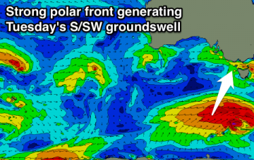
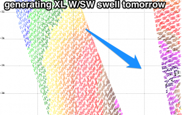
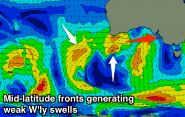
Fun W/SW swells from tomorrow afternoon but with onshore winds for the most part. Cleaner down South but too west to offer any real size at all.
Not the best outlook with average weak and small westerly swells over the coming period with average winds for locations east of Melbourne. Fun S/SW swell for Tuesday morning.
Whilst Thursday and Friday are motoring along with building S’ly swells, the primary Tasman Low - by this time just off the west coast of New Zealand’s South Island - is expected to reintensify, generating gale to storm force S thru’ S/SE winds that will kick up a large swell for Saturday.
You know it’s tiny when the Sydney buoy is recording a metre of swell out of the west.
Weak S/SE windswell tomorrow and Friday ahead of a late increase in SE swell, and then stronger E/SE groundswell Saturday, easing Sunday. S'ly swell for next week.
Average windswell tomorrow with a developing onshore wind, cleaner but easing Friday, tiny until early next week.
XL stormy swell tomorrow with strong onshore winds, easing into Friday with large swell again Saturday but onshore. No let up in the winds next week.
Easing S'ly swell tomorrow morning ahead of a late pulse in new swell, easing Friday with favourable winds. Good W'ly swells for the weekend but onshore for the Mid Coast, much better Monday.
Large building S/SW swell tomorrow but onshore at most locations, much better as it eases Friday with N'ly winds. Average from the weekend with good winds for the Surf Coast but no decent swell.
Good SW groundswell for today and tomorrow, with a larger pulse late week and good large SW swells from Tuesday next week.