Extended trade-wind swell event ahead, with juicier surf still a possibility
Wednesday, 29 January 2025

Extended trade-wind swell event ahead, with juicier surf still a possibility
Wednesday, 29 January 2025
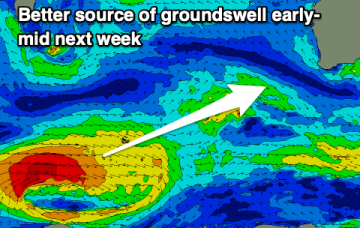
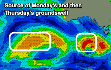
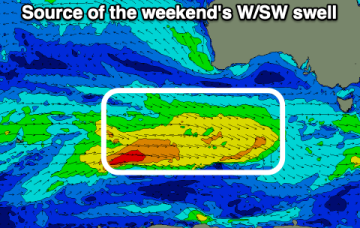
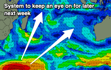
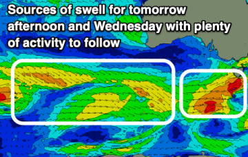
The tropics is in an active state with multiple low centres expected along the monsoon trough as it responds to a phase of the MJO passing into Australian longitudes. Still plenty of uncertainty there, with any meaningful swell subject to extremely low confidence in specifics.