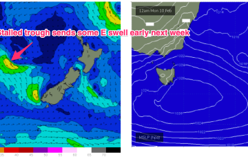
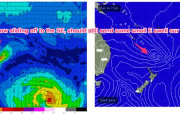
Easing swells short term with next week now looking a bit lacklustre
Wednesday, 5 February 2025

Easing swells short term with next week now looking a bit lacklustre
Wednesday, 5 February 2025
Central QLD Forecaster Notes by Steve Shearer (updated on Wed Feb 5th)
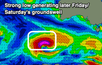
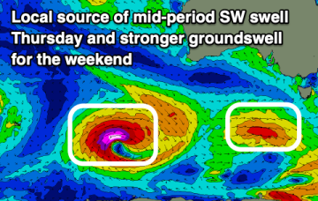
This week and next week (Feb5-Feb14)
Central QLD: Easing swells short term with next week now looking a bit lacklustre
Plenty of fun waves in the recent past, easing into the weekend.