Make the most of the next two days
Wednesday, 21 October 2020
Make the most of the next two days
Wednesday, 21 October 2020
Lots of groundswell for the weekend, but poor winds to boot. More in the Forecaster Notes.
Lots of groundswell for the weekend, but poor winds to boot. More in the Forecaster Notes.
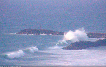
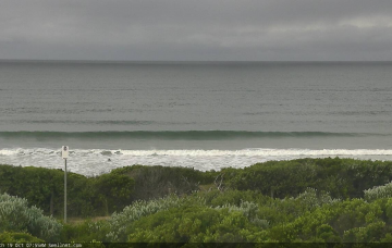
Late Tuesday afternoon, we may see the leading edge of the next round of groundswell nose into the coast, generated by an incredible Southern Ocean Low currently to our south-west. More in the Forecaster Notes.
It’s not a great week of waves coming up. And, it looks like another weekend of gusty northerlies, persisting into early next week. Otherwise, the second half of next week looks much better. More in the Forecaster Notes.
Unfortunately, a quiet synoptic chart across the Tasman Sea this week means we’re looking at a continuation of small swells. Fortunately, the long term outlook has a lot more potential. More in the Forecaster Notes.
There’s a slight tweak to the overall forecast for the Victor region, in the negative - and that’s thanks to a minor strengthening of the regional high pressure system throughout the week. More in the Forecaster Notes.
This week’s surf outlook can best be described in firefighting parlance, as ‘watch and act’. More in the Forecaster Notes.
There’s not a heck of a lot of swell on the way for this week. More in the Forecaster Notes.
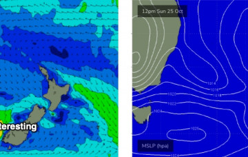
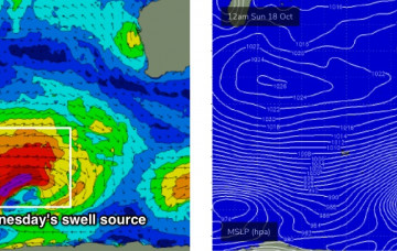
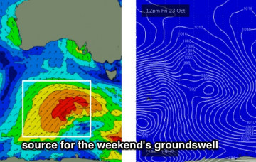
A series of powerful Southern Ocean lows in our far swell window have generated (and are still generating) excellent long period swells that will arrive in succession from Sunday evening onwards. More in the Forecaster Notes.
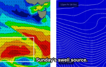
We’ve got a good run of surf on the way. The main reason for this is a low latitude Southern Ocean storm track, which is positioned much more favourably within our swell window. More in the Forecaster Notes.
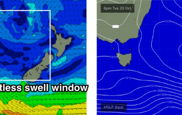
There’s one main window of opportunity across the broader coast this weekend. More in the Forecaster Notes.