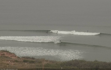
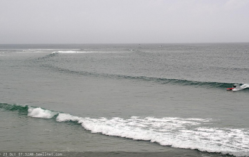
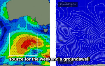
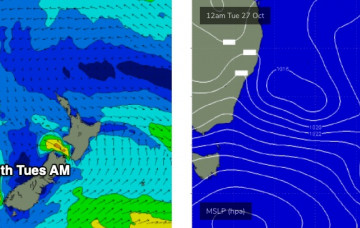
Next week looking pretty fun
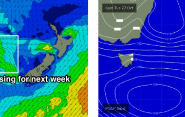
We’ve got an extended run of strong SE swell for Northern NSW, and SE Qld should also pick up some fun waves next week. More in the Forecaster Notes.
We’ve got an extended run of sizeable SE swell for our region. More in the Forecaster Notes.
The rest of next week looks rather dynamic, though the models are vastly split on solutions. More in the Forecaster Notes.
With poor winds expected all weekend, there’s no need to waffle on about the synoptics (though, I’ll give it a crack, of course). More in the Forecaster Notes.
Next week’s outlook is very tricky though quote promising. More in the Forecaster Notes.
The next swell is on the way. I’m anticipating the leading edge to reach the Cape Sorell buoy tonight. More in the Forecaster Notes.
Next week is still looking to be pretty large, thanks to an amplifying Long Wave Trough west of WA over the weekend. This will set up a conveyor belt of powerful fronts and lows through our mid range swell window, covering an impressive region of the southern Indian Ocean. More in the Forecaster Notes.
Looks like a couple of days of very average conditions ahead. But next week looks really good... potentially. More in the Forecaster Notes.
The synoptics are dominated by a complex pattern of low pressure troughs from the Tasman Sea all the way across the eastern states and out into South Australia. This is expected to produce a dynamic period of weather for NSW, though not a lot of swell. Next week though... get ready! More in the Forecaster Notes.
Because tomorrow’s swell is essentially independent from Tuesday’s - i.e. it needs to be treated on its own merits, instead of recalibrating because of anomalous observations upstream - I don’t think I’m going to change the forecast for Thursday. More in the Forecaster Notes.