Wintry conditions and S swells ahead
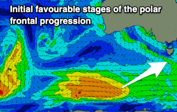
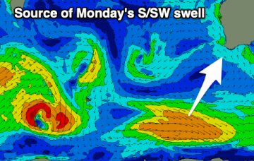
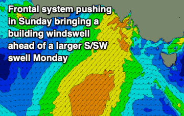
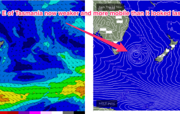
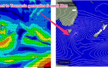
The low forming just to the E of Tasmania overnight sees fresh SW to S’ly winds develop through the day, with a quick rise in S swell expected through the day.
No great pressure gradient squeezes are on offer at present with only flabby high pressure drifting NE in the Tasman sea. Weak swells and wind changes continue.
The coming days will be poor but we should see more options opening up from Sunday.
The troughy pattern will see multiple wind changes through to the end of the week with some flukey swells on offer before the inland low enters the Tasman this weekend and supplies a slightly larger S swell.
Conditions will be mostly good and offshore each morning but the lack of swells with size and push will continue.
Finding a clean wave with size and quality will be tricky this period. There is a window early-mid next week though.
There'll be a couple of small windows for the keen on both coasts over the coming days but the swells will be weak. Next week sees a bit of size developing, though protected spots will fair best.
That leads to a couple of days of small, weak surf before the low shifts East of Tasmania on Thursday.
There's a good swell due tomorrow but you'll have to work the winds. The rest of the week looks poor with mostly average conditions. There's more action next week.
A blocking setup will keep the state very quiet over the coming period but with favourable morning winds.