Fun run of inconsistent S/SE swell
Monday, 3 July 2023
Fun run of inconsistent S/SE swell
Monday, 3 July 2023
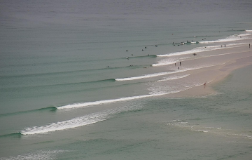
We've got a good week of waves with light winds and pulses of south-southeast swell.
We've got a good week of waves with light winds and pulses of south-southeast swell.
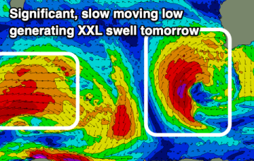
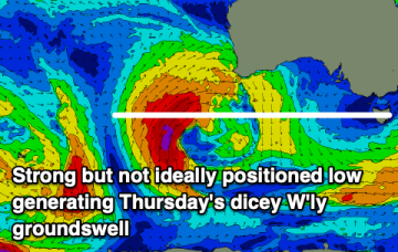
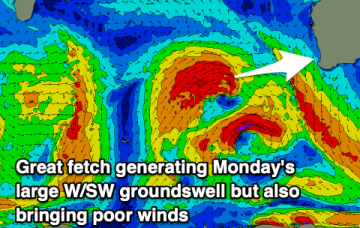
Poor conditions along with an XXL swell is due tomorrow, easing through Wednesday and Thursday. Windows for a clean wave will be limited.
Before we get to that point, we still need the developing S/SE swell to push through, reach a plateau and then slowly abate - which will happen overnight and then gradually through Tuesday.
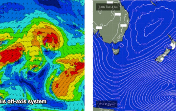
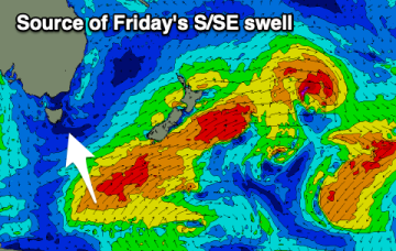
The Long Wave Trough responsible for our current southerly swell regime is exiting New Zealand longitudes, though we’re still seeing strong polar activity off the ice shelf.
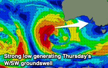
The roaring forties will roar to life with an extended run of large, windy swells on the way.
We've got a run of northerly winds with smaller, slower swells this week ahead of some large energy developing through the weekend.
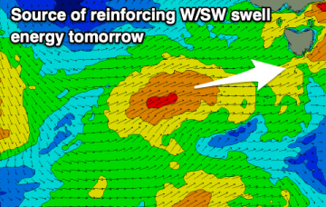
A series of overlapping south swells remain on the menu for the next three or four days, thanks to a series of powerful fronts sliding around an amplifying long wave trough over New Zealand longitudes.
Strong overlapping south swells remain on the menu for the next three or four days, thanks to a series of powerful fronts sliding around an amplifying long wave trough over New Zealand longitudes.
There'll be swell on the weekend but with generally poor conditions, better with a funky S/SE pulse next week.
The weekend won't offer any surf at all with poor, strengthening northerly winds. Early next week looks to get big but with poor winds.