Indonesia/Maldives forecast March 21
Thursday, 21 March 2024
Indonesia/Maldives forecast March 21
Thursday, 21 March 2024
Easing surf over the coming days, with larger energy due into the end of the month.
Easing surf over the coming days, with larger energy due into the end of the month.
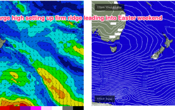
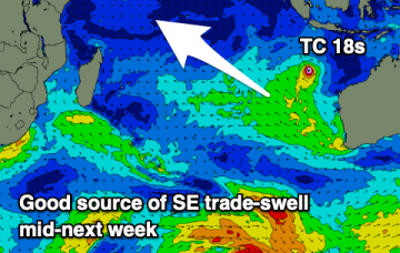
Into next week and we’ll see a new high pressure system set up a SE surge as we move into the Easter weekend.
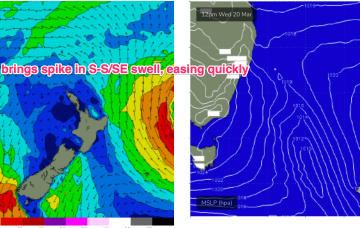
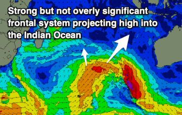
We’ll see some frontal activity over the weekend and S pulses next week before another strong, blocking high sets up a ridge next week.
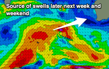
An active and strengthening progression of cold fronts and a final low will bring plenty of swell along with favourable winds.
The NZ high and a long monsoon trough has generated a useful fetch of tradewinds in the eastern swell window, which has maintained E’ly swells in the sub-tropics, E/NE in temperate regions.
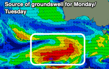
A good swell is due Friday and Saturday morning, then slow ahead of more action later next week/weekend.
The NZ high has generated a useful fetch of tradewinds in the eastern swell window, which has maintained E’ly swells in the sub-tropics, E/NE in temperate regions. That trade fetch breaks down in the short term before rebuilding again at more Northern latitudes. We’ll see some frontal activity over the weekend before another strong, blocking high sets up a ridge next week.
The coming period will provide plenty of swell for the South Coast but with average winds until early next week.
There's no issue with swell over the coming period, it'll be a matter of working the local, varying winds and conditions.
Moderate sized swells this week, slower next week ahead of some more action the following weekend.