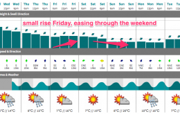
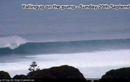
Easing trend with fun SE swell on Monday
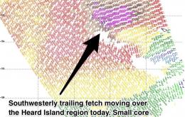
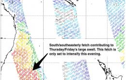
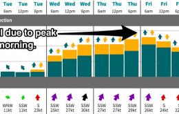
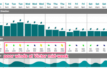
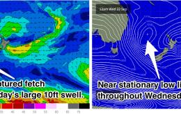
There haven’t been any significant other swell generating systems during this time, so the size will diminish steadily throughout the coming days.
Not a whole lot of action expected this week. Friday and Saturday will see a small lift in size, but nothing worth writing home about. The Long Wave trough should become more active over the Indian Ocean next week leading to more promising prospects.
No notable surf is expected for the rest of the week.
A lage swell will continue to build, peaking late on Thursday for northern NSW and Friday for southeast QLD. South/southwesterly winds each morning will lead to good conditions across the points. Keep an eye out on the local wind obs.
Nothing great expected for the rest of the week but it’ll be a small improvement over the last few days.
Wild conditions will continue on Thursday, with the swell peaking in the 10ft range. There will be a window of opportunity for protected southern ends early under south/southwesterly winds. More exposed spots will be huge and heavily wind affected.
If you didn't get lucky over the past couple of days, make sure you surf tomorrow. The outlook for the rest of the week is looking pretty slow.
All this detail is fairly insignificant ahead of a much more exciting large south swell which has been the talk of the town.
Local winds are the wild card for the next few days.
The surf will build rapidly on Wednesday before peaking at around 10ft on Thursday morning. This is a seriously big swell event accompanied by strong southerly winds. Protected southern corners will be the only workable options with protection from the wind and a more manageable size. Keep an eye out for early southewesterly winds each morning.