Poor period ahead

Victoria Forecast by Craig Brokensha (issued Wednesday 15th January)
Best Days: Locations east of Melbourne possibly early Friday
Recap
Onshore winds but without too much strength yesterday and workable, bumpy sets easing from 2ft on the Surf Coast, 2-3ft to the east. Winds tended more variable to the east through the day as well, creating improving conditions.
Today, our good new SW groundswell has filled in well with 3-4ft waves on the Surf Coast, 6ft on the exposed beaches to the east and mostly clean conditions with some lump across locations west of Melbourne.
We'll see winds remain favourable and tending more N'ly into the middle of the day (NW on the Surf Coast) ahead of the SW change mid-afternoon, so get a couple of surfs in if you can.


Smokey scenes in Torquay this morning
This week and weekend (Jan 16 - 19)
Make the most of today as the coming period is looking fairly forgettable.
This afternoon's change will be linked to a trough moving in from the west, but stalling in eastern Bass Strait as a strong high tries to squeeze in from the west. This will see strengthening SW tending S/SW winds tomorrow as today's swell eases from 3ft on the Surf Coast and 4-5ft to the east.
The high will slide in on Friday but there may be a window of workable conditions across selected beaches. A variable breeze is possible on the Mornington Peninsula and Phillip Island before swinging E/SE and strong. Keep an eye on the local wind observations for a window of OK surf.
Our new mid-period SW swell should be in the mix as well, generated by a weak but broad frontal system that developed on the tail of the strong low linked today's swell. The Surf Coast magnets should see 3ft sets, with 4-5ft sets to the east.
The strengthening E/SE-SE winds will produce a building SE windswell through the day across the Surf Coast, to a similar 3ft or so but with terrible conditions.
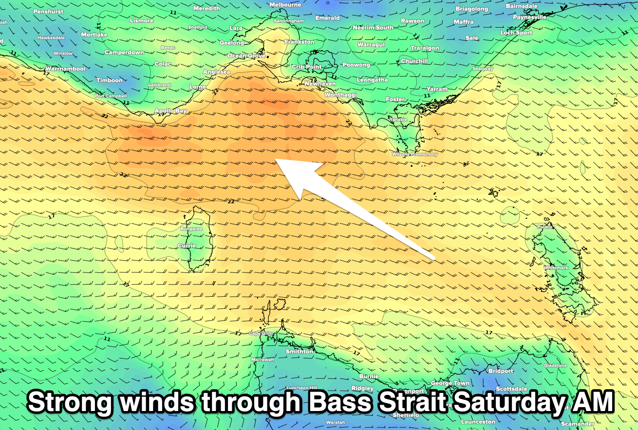
Unfortunately the weekend will remain poor with strong E/SE-SE winds and a junky SE windswell to 3ft+ on the Surf Coast Saturday, 3ft or so on the Mornington Peninsula. Winds through Bass Strait should ease a little into Sunday resulting in a drop in windswell, but with a moderate to fresh E/SE-SE breeze, conditions will remain poor.
This will be a result of another inland trough squeezing the northern flank of a strong high. GFS has this trough sitting further south and also being deeper, possibly swinging winds E/NE on Sunday, but we'll have to have another look at this Friday.
We're likely to see any trough push east through early next week, swinging winds away from the south-east, but swell wise, there'll be nothing really of note owing to the blocking action of the strong highs.
Small background and inconsistent levels of mid-period swell are possible, but otherwise there doesn't look to be any decent swell until late next week/weekend. More on this Friday.
Comments
Looks like the Straya! weekend may have something brewing...... synoptic charts looking more interesting..... :)