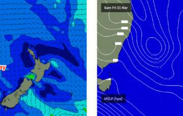
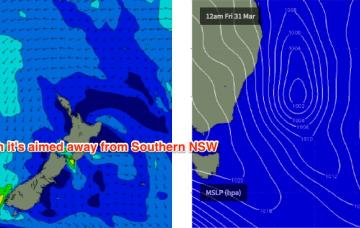
Windy conditions ahead for Southern NSW, with a few small windows
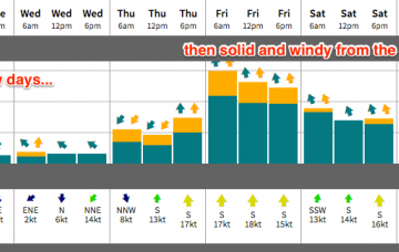
Saturday should be OK though it may be a little lumpy and leftover from Friday’s winds.
As alluded to in Monday’s notes, we have another large swell expected this weekend.
So, here comes the expected large swell for Thursday.
We’re at the bottom of the current swell cycle, with a new long period S/SW groundswell expected to build in the early hours of Wednesday morning.
As it turned out, TC Debbie developed a little more slowly than initially thought, tracking very slowly to the mainland but at the same time, broadening the width of the fetch as it strengthened. Although right on the periphery of the swell window, this has resulted in a much bigger swell than initially expected.
On Sunday, a very long period (19-20+ second) S’ly groundswell - originating from a sneaky polar off the Ice Shelf south of SA this Wed and Thurs - is expected to make landfall across the Sydney region.
We’re still on track for a very large, powerful swell to arrive mid-late week. But there are several stages of swell ahead and with a tricky wind outlook we need to hone into the specifics.
The interesting thing about this week’s upcoming swell on Wednesday, Thursday and Friday is that it'll probably be a distraction, and many people many not realise that there’s a likely better swell inbound for the weekend. So don’t over-froth too hard over the coming days as there’s more to come.
Good easing E'ly swell tomorrow with N'ly winds, cleaner and smaller Sunday. Very slow next week.
Clean conditions and small fun waves all weekend, with a slightly bigger pulse Monday morning. Larger W/SW swells from later Tuesday through the end of the week.