Great surf Saturday, average Sunday

Victoria Forecast by Craig Brokensha (issued Friday 25th August)
Best Days: Surf Coast Saturday, Surf Coast Monday morning, Tuesday, early Wednesday, east of Melbourne Thursday and Friday
Recap
Another great morning of Surf Coast reef waves yesterday with offshore winds and 3ft sets. An onshore change moved in late morning and conditions were average into the afternoon.
This morning the swell is a bit smaller as we fall in between events, but some new W/SW swell is due to show into this afternoon as winds persist from the W/NW. We should see more consistent 3ft sets developing on the Surf Coast so keep an eye on the buoys and surfcams.
This weekend and next week (Aug 26 – Sep 1)
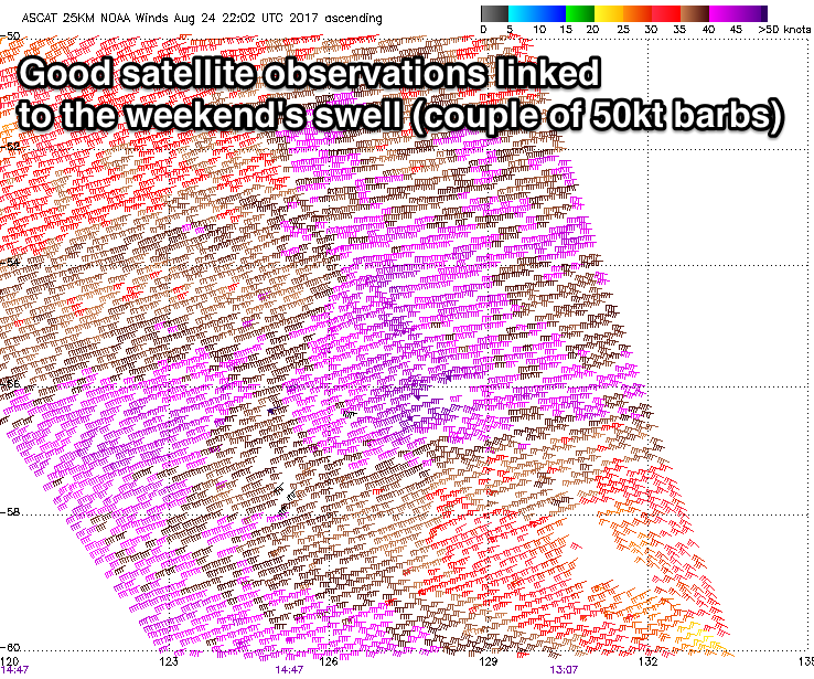 Later today's increase in W/SW groundswell will be linked to a good pre-frontal fetch of W/NW gales moving through our swell window the last couple of days.
This swell should peak tomorrow morning around 3-4ft across magnets on the Surf Coast and 6ft on the sets across the Mornington Peninsula.
A much better and stronger SW groundswell will arrive through the afternoon, produced by a broader, elongated and stronger fetch of polar W/SW gale to severe-gale winds.
Satellite observations of this fetch look great and we should see the Surf Coast kicking to 4-5ft through the mid-late afternoon, though on the high tide (not ideal) with 6-8ft sets on the Mornington Peninsula.
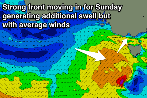 Winds will remain great all day for the reefs with a moderate to fresh NW tending W/NW wind, but into Sunday morning, we're now looking at gusty S/SW winds across all locations as a secondary polar front pushes up and into us tomorrow.
This will keep wave heights up through Sunday in the 5ft range on the sets across the Surf Coast and 6-8ft on the Mornington Peninsula but with those onshore winds. There is a very slim chance for an early W'ly around Torquay, but it's probably not worth the drive from Melbourne.
We should see the surf starting to ease into Monday from a good 4ft on the Surf Coast and 5-6ft+ to the east but with lingering SW winds. The Torquay region is much more likely to see an early W/NW breeze, creating fun conditions.
A reinforcing SW groundswell is due to fill in through Tuesday, probably arriving mid-morning, generated by a polar fetch of pre-frontal W/NW gales.
This should keep the Surf Coast going around the 3ft range with offshore winds from the NW tending W/NW.
Longer term, some fun SW swell is likely Thursday from a relatively weak front early next week, though winds look to swing onshore through Wednesday with better winds for the beaches into Thursday and Friday, but we'll look at this closer Monday. Have a great weekend!
Comments
13th Beach looking attractive this AM.
TQ ain't too shabby either.