Poor week, better weekend, more active next week

Victoria Forecast by Craig Brokensha (issued Monday 20th March)
Best Days: Selected spots east of Melbourne tomorrow, east of Melbourne each morning over the weekend
Recap
Small weak waves Saturday morning with a mix of SE windswell and W/SW swell to 1-2ft on the Surf Coast and 2-3ft on the Mornington Peninsula.
Sunday was similar in size and clean again, best at exposed breaks across the state.
This morning a very inconsistent long-range W/SW groundswell is filling in with 3ft sets on the Surf Coast and 4-5ft waves on the Mornington Peninsula under variable winds. We should see magnets on the Surf Coast reach 3-4ft during the day with 5-6ft+ sets on the Mornington Peninsula but the wait between those sets is around 15 minutes (not ideal).
This week (Mar 21 – 24)
Today's very inconsistent W/SW groundswell was generated in our far swell window, providing XL surf in WA, large waves across South Oz and very inconsistent sets on our beaches and reefs.
This swell is expected to peak sometime this afternoon and will ease off slowly through tomorrow, further Wednesday.
The Surf Coast should ease from a very inconsistent 2-3ft with 5ft sets on the Mornington Peninsula. Winds are an issue and not ideal, with a moderate to fresh E'ly through the morning and early afternoon, favouring selected breaks east of Melbourne.
Come Wednesday fresh SE tending E/SE winds will create terrible conditions and produce some small SE windswell.
These poor winds from the south-eastern quadrant are linked to a developing low off the East Coast of Tasmania and will persist through Thursday and Friday while the low slowly drifts towards New Zealand.
This will spoil a new S/SW groundswell for Thursday morning, generated by a strong polar low the last day or so, south-southwest of WA. This low is now weakening while passing south of the country, with a good SW groundswell due to arrive later Wednesday and peak Thursday morning to 3ft to occasionally 4ft on the Surf Coast and 5-6ft on the Mornington Peninsula.
As touched on above, conditions will be poor.
This weekend onwards (Mar 25 onwards)
 Over the weekend some small fun pulses of SW groundswell are due across the state, generated by dual pre-frontal W/NW fetches through our far swell window south-west of WA.
The second fetch will be stronger and broader, producing the bigger increase for Sunday.
Firstly on Saturday the Surf Coast should see 1-2ft waves from the first pulse with 3-4ft sets on the Mornington Peninsula with light N/NE offshores.
The secondary increase Sunday will be less consistent but with 3ft sets on the Surf Coast and 4-5ft waves on the Mornington Peninsula with what looks to be morning offshores again.
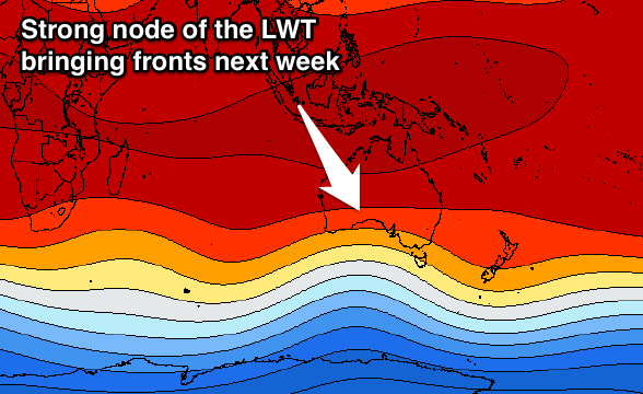
This will hopefully be the end of our long-range and small swell energy, with a vigorous mid-latitude frontal progression due to fire up into next week under the influence of the Long Wave Trough. More on this Wednesday.