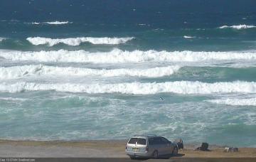
Big Sunday for Northern NSW; easing next week with northerlies
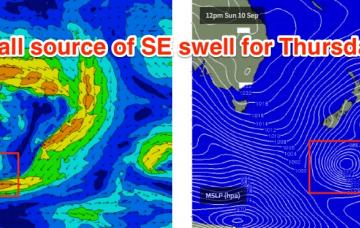
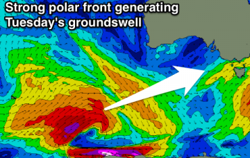
Today’s upwards trend out of the south is only the beginning.
Core wind speeds around the responsible low have been clocked in well over 50kts so we’re looking at 18-19 second peak swell periods as the swell front hits; of which the sheer length and breadth of the fetch will ensure a very large swell event for Sunday morning.
Strong large S'ly groundswell filling in tomorrow, peaking into the afternoon and easing from Sunday with favourable winds.
New S'ly swell for tomorrow, mixed in with an inconsistent SW groundswell, easing Sunday, with a new W/SW swell for Tuesday.
Small background energy with variable winds early tomorrow, onshore with a building swell Sunday, peaking Monday but with poor winds. Larger swell for Tuesday afternoon, easing Wednesday as winds swing offshore. Good large swell to end the week as well.
New inconsistent S/SW groundswell for tomorrow morning, easing through the weekend with favourable winds, all day offshore Sunday. New good SW groundswell for Tuesday with good winds for the South Coast, with a larger W/SW swell Thursday though winds are still up in the air.
Easing SW swell over the weekend, cleanest Sunday with a period of N'ly winds Monday morning for exposed beaches. Good swell for Tuesday, followed by another swell Thursday though with average winds.
The broad outlook is up throughout Thursday, down temporarily Friday morning, then up again strongly Friday afternoon across the Mid North Coast ahead of a large weekend of southerly swell in Northern NSW, with smaller conditions across SE Qld.
Easing S'ly swell tomorrow, with some new energy Friday, larger Saturday and then easing Sunday with the best winds.
Clean easing SW swell tomorrow, with a new SW swell Friday with a period of OK winds. Onshore and larger S/SW swell for Saturday, easing Sunday.