Easing W/SW swell, cleanest on the Mid Coast
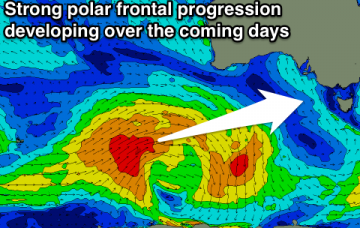
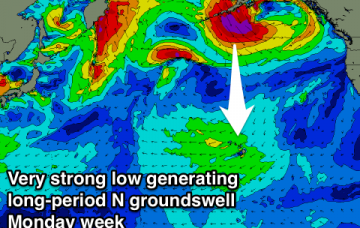
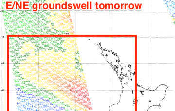
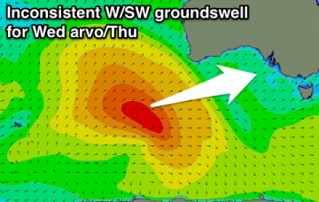
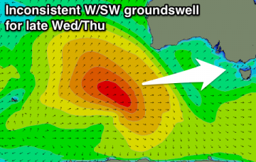
Fun easing W/SW swell tomorrow and Friday, tiny into the weekend with dicey winds for the South Coast and cleanest on the Mid.
Fun clean and inconsistent W/SW groundswell for tomorrow, easing through the day, further Friday and into Saturday with favourable winds each morning. Good swell due early next week, though winds look dicey.
XL N'ly swell due Thursday, easing into the weekend ahead of another large pulse Monday morning. NW swells arriving into early December.
Small to tiny amounts of swell with less than favourable winds. Likely biggest and best tomorrow (but only 1-2ft).
Tiny to flat for the period, with a slight increase in W'ly groundswell later Wednesday and Thursday.
Strong SW groundswell filling in tomorrow with good winds for protected spots, best Wednesday morning with a straight offshore wind as the swell eases.
So, we look like we’re close to the top of the initial swell cycle from our lovely little weather system that developed north of New Zealand last week.
Our incoming E/NE swell will reach a peak in size overnight or early Tuesday and then slowly trend down into the afternoon and through Wednesday.
Tiny and clean tomorrow, with a new W/SW swell for Wednesday morning, stronger into the mid-late afternoon with a stronger pulse. Easing surf Thursday, and poor to end the week.
Tiny tomorrow, with a small increase in W/SW swell Wednesday morning, building further later with a better pulse of W/SW swell, peaking early Thursday. Favourable winds for exposed beaches all week.