Poor end to the week, better weekend
Wednesday, 20 November 2024
Poor end to the week, better weekend
Wednesday, 20 November 2024
Give the end of the week a miss with the weekend coming in better (mainly for the South West).
Give the end of the week a miss with the weekend coming in better (mainly for the South West).
The Mid Coast will bottom out as the South Coast provides the best conditions ahead of an average week next week.
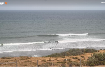
The beaches will become much cleaner over the coming days but the swell will be on the edge of being too big and overpowering.
Moderate pulses of swell for most locations this week, a little slower and mixed next week.
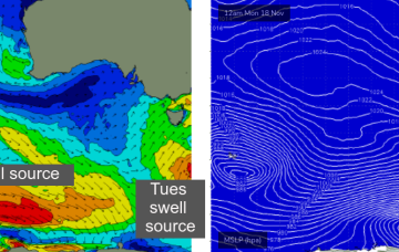
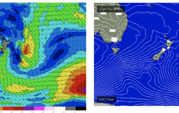
A new S/SW swell sourced from a polar low will build across the coast into Tuesday, but local winds will create some issues on the surface.
Thursday is where things get a little more interesting.
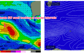
The Indian Ocean remains in a progressive pattern with a large high pressure belt and zonal disturbances in the Roaring 40’s supplying moderate overlapping SW pulses on a 24-36hr basis. Basically, overlapping swell pulses from these zonal storms will hold moderate surf all week, with subtle ups and downs.
Easing surf is expected all weekend with generally light variable winds both days under a broadscale troughy pattern.
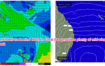
We’ll see a strong high edge in from the Bight early this week and take up residence in the Tasman Sea, with a broad and persistent Tradewinds fetch developing in the Coral Sea. We should see just rideable surf through Tues and Wed ramp up on Thurs as windspeeds increase in the Coral Sea.
We’ll see some small S pulses and NE windswell on the menu this week.