Tricky wind outlook thanks to troughy weather
Wednesday, 27 November 2024
Tricky wind outlook thanks to troughy weather
Wednesday, 27 November 2024
Winds will be more onshore than not this period.
Winds will be more onshore than not this period.
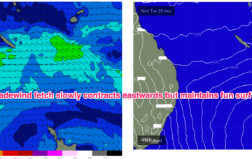
A tradewind flow focussed around the New Caledonia area and out into the South Pacific slot will maintain fun E’ly tradewind surf in the sub-tropics.
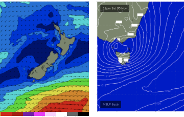
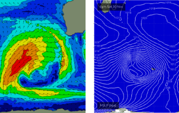
We’ll see an increasing SE-E flow aimed at Tasmania as winds feed into the cut-off low, generating E’ly swells for NETas into the weekend.
A tradewind flow focussed around the New Caledonia area and out into the South Pacific slot will maintain fun E’ly tradewind surf in the sub-tropics.
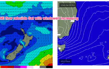
The N’ly flow gets briefly disrupted by the trough in temperate areas before resetting again for the weekend, generating more NE windswell.
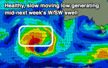
Local winds will favour the South Coast this period which is quite out of season. We've then got a good west swell due next week.
There's been a change to the wind outlook into the end of the week, with better surf due next week.
Most locations are set to offer good waves this period, but with tricky winds in the Mentawais and across the Maldives.
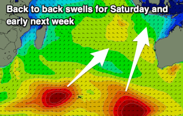
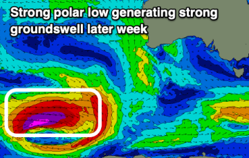
Later Wednesday, the leading edge of a new long period groundswell is expected to arrive though we won’t see the main size increase until Thursday.
We've got some decent swell due this period but winds won't play ball.