Lots more swell to come
Friday, 13 August 2021

Lots more swell to come
Friday, 13 August 2021
Plenty more surf and swell to come, cleanest on the weekend and deteriorating through next week when largest.
Plenty more surf and swell to come, cleanest on the weekend and deteriorating through next week when largest.
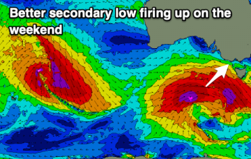
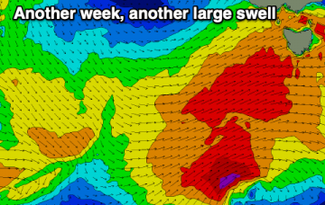
With severe gales extending from Tasmania down to 55S and a slightly more favourable SSW tilt in the winds which then push up adjacent to SE Tasmania during Tues..
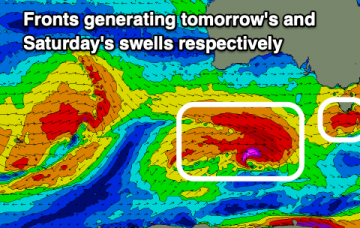
We've got some better, localised swell prospects on the cards for the coming days with lots of stronger energy from the weekend.
The result is a long, broad fetch of severe gales from 55S up to Tasmanian latitudes Sun , extending even further south late Sun into Mon with a more favourable SSW tilt in wind alignment in the fetch.
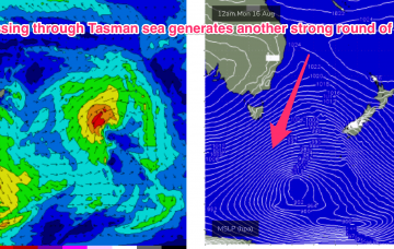
The very active Southern Ocean pattern reaches a crescendo late Sun into Mon with an intense, complex polar low which becomes slow moving as it enters the Tasman sea swell window.
Easing size from today but good, reinforcing swells for the period with good winds in Perth and Mandurah, improving in the South West from Sunday.
Lots of surfing options for the South Coast with good windows on the Mid Coast working the winds.
We'll see increasing swell activity from tomorrow, initially west in nature but improving in direction from the weekend and into next week as winds favour protected spots.
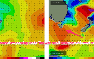
As a cold front approaches Wed, NNW’ly winds freshen adjacent to the NSW coast and out into the Tasman sea. This is expected to generate a small 2ft NE windswell late Wed
Nothing too major this week but we'll see the surf jump in size from late week and into the weekend.