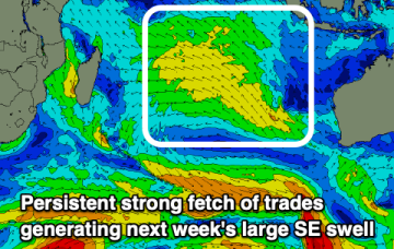
Good swell for the weekend with average winds, flukier next week
Friday, 25 August 2023
Good swell for the weekend with average winds, flukier next week
Friday, 25 August 2023
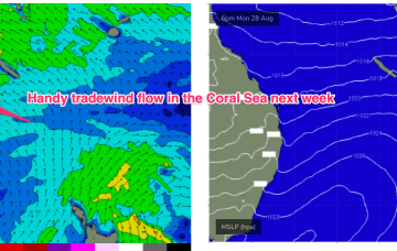
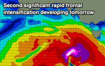
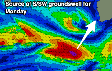
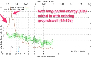
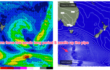
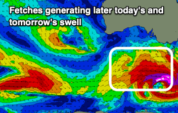
We've got a strong pulse of W/SW-SW swell for later today and tomorrow but with average winds, deteriorating further Sunday. Next week looks smaller and fluky.