Small surf options for the coming days
Monday, 6 November 2023
Small surf options for the coming days
Monday, 6 November 2023
Light morning winds and small swell pulses should provide fun surf options.
Light morning winds and small swell pulses should provide fun surf options.
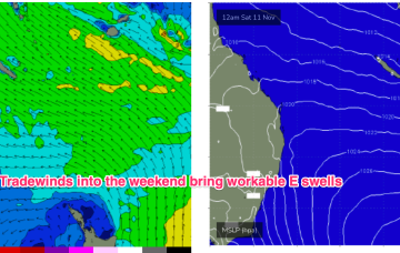
Surf-wise the tradewind fetch will be chugging away and like all tradewind fetches once we get a fully developed sea state we should see an improvement in size and quality.
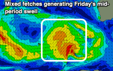
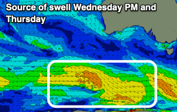
All is on track for a fun swell late week, improving while easing on the weekend.
The high initially weakens with a lighter onshore flow before re-strengthening as it approaches New Zealand and has the pressure gradient tightened on the western flank by the complex trough systems. That will produce a N’ly flow, expected to increase as the week goes on with increasing NE windswell late in the week and early weekend.
The coming week will see flukey winds for the South Coast with small swells. A better swell is due on the weekend with favourable winds for the gulf.
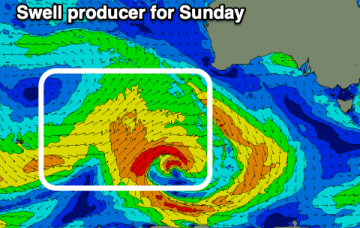
There'll be windows of surf across both regions but with generally small surf as troughy weather dominates. More size is due from Sunday but with deteriorating winds.
The coming period looks fun with light winds each morning and small levels of persistent swell.
Once the tradewind flow sets up early next week as the blocking high enters the Tasman we should start to see an increase in tradewind swell, likely by Tues at the latest.
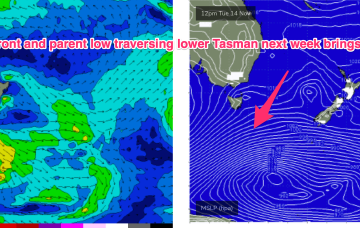
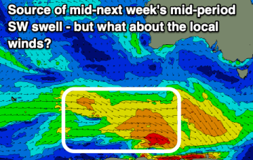
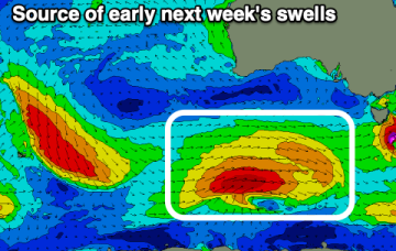
Into next week and the main story is a large high moving into the Tasman and becoming slow moving, setting up a summer-style blocking pattern with developing NE winds and NE windswell, becoming solid by the end of the week.
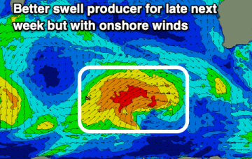
Surf options remain minimal for the period, while a better swell for late next week looks to be met with onshore winds.