Active week of swells with workable winds
Monday, 26 February 2024
Active week of swells with workable winds
Monday, 26 February 2024
The surf looks stronger this week with windy though workable conditions.
The surf looks stronger this week with windy though workable conditions.
It looks like the peaks in swell seemed to be timed with the weekends of late, smaller and cleaner through the weeks.
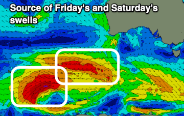
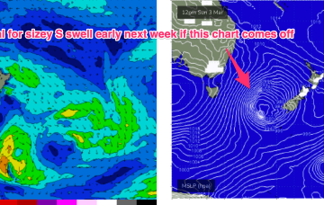
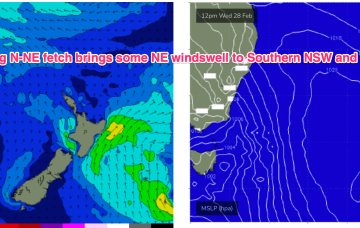
The high cell is weak so we’re looking at a fairly uninspiring end to Summer, with some mid week NE windswell for Southern NSW and small background E swells for the sub-tropics. After that quiet spell extends into the start of Autumn a stronger frontal intrusion into the Tasman looks likely next week with some robust S swell accompanying it.
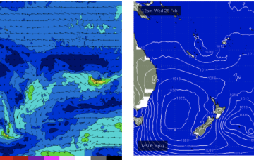
We’ve got a weak, troughy pattern in the Tasman Sea, with a minor cold front passing to the SE of Tasmania and a new high pressure cell poised to enter the Tasman in it’s wake. The high cell is weak so we’re looking at a fairly uninspiring end to Summer, with some mid week NE windswell for Southern NSW and small background E swells for the sub-tropics.
Hit the beaches over the coming days and then try and work the winds for later week and the weekend.
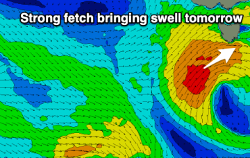
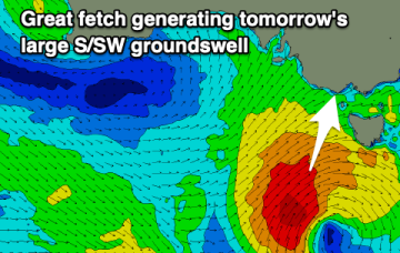
A good kick in swell will be spoilt by winds tomorrow, with it fading rapidly into Sunday.
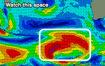
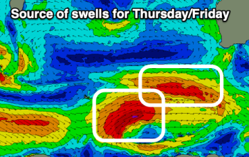
The outlook becomes more promising swell wise later next week but winds will remain an issue.
Not much else on the radar after that- looks like a very quiet start to Autumn with some small/tiny days to end next week and enter the first weekend of March.
The next surfable day is Wed as high pressure moves into the Tasman and a strong N’ly flow forms along the NSW South Coast down to Bass Strait.
The South Coast is now set to be cleaner tomorrow morning but large and tricky. Sunday onwards (besides Monday) looks super fun.