Large to extra-large swells inbound
Friday, 24 May 2024
Large to extra-large swells inbound
Friday, 24 May 2024
The coming period is very active but there are windows of lighter winds to work around. Read on.
The coming period is very active but there are windows of lighter winds to work around. Read on.
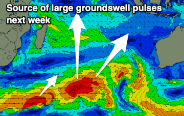
By Thurs we should start seeing slightly bigger E’ly tradeswell from a fetch developing next week in the Coral Sea.
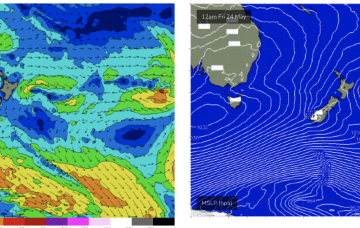
A complex polar low is approaching the NZ corridor and although the frontal progression looks a notch less favourable for swell production up the East Coast we’ll still see S’ly groundswell pulses over the weekend.
The South Coast looks great all period, with the Mid Coast building in size next week but with deteriorating winds.
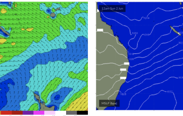
High pressure is approaching Tasmania with a weak trough expected to linger in the Tasman and across the North Coast over the weekend and lead to mostly light breezes, especially Sun. A complex polar low is approaching the NZ corridor and although the frontal progression looks a notch less favourable for swell production up the East Coast we’ll still see S’ly groundswell pulses over the weekend
High pressure is approaching Tasmania with a weak trough expected to linger in the Tasman over the weekend and lead to mostly light/variable breezes. A complex polar low is approaching the NZ corridor and although the frontal progression looks a notch less favourable for swell production up the East Coast we’ll still see S’ly groundswell pulses over the weekend.
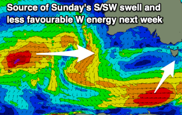
A weaker, stalling trough should create cleaner conditions today as our new swell builds. Next week looks strong from the west but tricky.
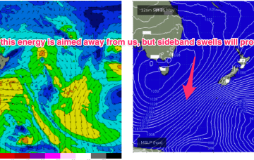
The run of south-west and south swell energy will come to an end through next week.
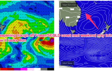
Another reinforcing high cell moves in from the Bight later this week, with a rebuild in SE winds better placed for swell generation in CQ.