Mid-strength black nor'easter on the boil

Sydney Hunter Illawarra Surf Forecast by Ben Matson (issued Wed 19th May)
Features of the Forecast (tl;dr)
- Large onshore surf Thurs
- Large, rapidly improving surf Fri as winds tending light/var, poss even offshore
- Solid, clean though slowly easing surf all weekend and into early next week
- Solid though very inconsistent E/NE groundswell building Wed, peaking Thurs/Fri
- Sizeable S'ly swell building Wed/peaking Thurs, easing Fri
- Favourable winds expected for this swell combo
Recap
A complex coastal trough with strengthening E’ly winds on its southern flank has delivered building E’ly swells and gusty onshore winds across most coasts over the last few days, with size around 4-6ft. Surfable options have been quite limited though and water quality has been very suspect thanks to the considerable rainfall runoff.
This week (May 22 - 23)
Fresh easterly winds across Coffs Harbour and light variable winds throughout Yamba (oscillating between westerly and easterly) means the axis of the trough is meandering in the vicinity of the Clarence Coast right now.
The trough will slowly turn south on Thursday, and then hasten its southerly track during the day, with the axis expected south of Coffs by Thursday night, Forster by Friday morning, and probably Sydney by late morning - eventually down to the Illawarra by mid Friday afternoon.
This timing is important because it will dictate the onset of favourable conditions. Because right now, we can expect a continuation of today’s mess into Thursday, albeit with more size as the wavelength draws out and the sea state becomes ‘full developed’.
In fact, this synoptic set up is akin to a mid-strength black nor’easter, with an impressive fetch stretching all the way from Far Southern NSW to Fiji and Tonga. A new E’ly dip will become embedded in the trough line near New Caledonia on Friday but I’ll discuss this a bit further down.
As for size, Thursday’s probably looking at an increase towards 6-8ft+ by late afternoon across most open beaches (smaller earlier), though conditions will generally be generally poor under fresh onshore E thru' NE winds.
Thursday’s late peak in size should hold into Friday morning and then gradually ease during the day. Don't be surprised if the Far South Coast shows a little more size, thanks to a better fetch alignment.
The timing of the southward-tracking trough is hard to extrapolate to local winds for Friday, because the models are not in full agreement as to how the coastal synoptics will evolve.
The most conservative view has light variable winds gradually extending south from Newcastle (early) to the Illawarra (late) however it’s quite likely that slack conditions will develop across all coasts more quickly, and we may see favourable winds everywhere from early in the day - though without the presence of a stiff offshore to iron out the bumps, it will take a few hours for things to clean up (winds will swing NW, just probably light in strength).
So, if you’re up for a session in large, chunky waves out of the E/NE, expect the best conditions to occur on Friday afternoon though it’ll be well worth keeping some flexibility for the morning session too.
This weekend (May 24 - 25)
The good news about the low-carb nor’easter is that the long fetch length means we’ll see only a slow decline in surf size once the swell window eventually quietens down.
And at this stage the fetch will remain active in the central/northern Tasman Sea swell window through Saturday, so the whole weekend will be flush with strong surf.
Even better - winds will swing to the W/NW as a powerful front rears up in the Bight. So conditions should be super clean both days and the weather should clear too.
At this stage I’m expecting surf size to be somewhere in the 4-6ft range early Saturday, easing to 3-5ft Sunday.
Sunday could also see a minor reinforcement of long range E/NE swell from the aforementioned E’ly dip developing on Friday up near New Caledonia, though no major size increase is expected.
Next week (May 26 onwards)
The weekend's swell source will continue to slowly ease into next week, however we have some new swell on the way from the E’ly dip near New Caledonia.
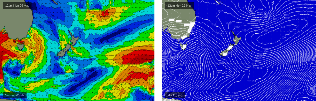
This system looks magical on paper. The dip is expected to track slowly to the east - not always a good sign for our prospects - but it’ll broaden and intensify as a large high east of New Zealand tightens the squeeze to its north (see below), becoming almost stationary south-east from Fiji for a day or two.
The travel distance from this system to the coast is much longer so we’ll see a smaller comparative size at the coast, however expectations are for an initial period of small background energy in the 3ft range Monday and Tuesday, before surf size builds slowly through Wednesday and peaks Thurs/Fri out of the E/NE. At its height we should be seeing solid 4-6ft sets access exposed Southern NSW coasts, though it will be quite inconsistent.
But that’s not the only swell source for next week.
A powerful Southern Ocean low and front will push across the SE corner of the country on Monday (see early stages above, in the Bight), and a broad fetch of SW tending S/SW winds across the south-western Tasman Sea will concurrently generate a series of large southerly swells that will probably punch a couple of feet higher than the E’ly swell (and with much more consistency). Surf size should come up quickly on Wednesday, peak Thursday and then ease through Friday.
At this stage the fronts are expected to track reasonably quickly into the Tasman Sea and therefore their influence on local winds may be only brief. As such the middle to latter part of next week is shaping up for an impressive, sizeable swell combo from the south and east with favourable winds to boot.
More on that in Friday's update.
Comments
Best news all week,i can feel a quickening in the nether regions
Lets hope it plays out because this rubbish now certainly didnt
YESSSSSS!
went for a fitness paddle this morning with extremely low expectations and caught a couple, wind dropped out between the rain squalls. won my heat because i was the only one out.
this forecast looks good enough to guarantee a downgrade.
Yeah I often score a Yeti cooler when I'm the only one out
The worst is when you paddle battle yourself off the peak
Nick Gee brilliantly conveyed.
Even though we're less than twelve hours out, there's still major variations in the wind outlook for tomorrow morning. Here's the 1pm forecast from GFS (top), EC (middle) and ACCESS-C (high res, bottom). Which also corresponds with a descending order of optimism.
Crazy, what’s your money on?
Winds dropped below 10kts and went variable in Newcastle around 4:30am.
But Norah Head is still gusting N/NE around 26kts (and it's of course gusty onshore throughout Sydney).
Looks like it'll be a late arvo cleanup along most beaches.
Pretty much rained all night here, but glad to see the radar indicating the rain has pretty much moved south now. The timing couldn't be better, hello sunshine and offshores and waves all weekend!
Hope the westerlies clean up the chocolate coloured water…. Bull shark heaven around all the open lagoons on the CC….hopefully some new decent banks