Indonesia/Maldives forecast Apr 3
Thursday, 3 April 2025
Fun swell for the weekend and next weekend.
Our current S/SE groundswell will ease tomorrow with less than ideal winds, with more options from Friday.
Nothing of any interest this week with weak pressure gradients in the Coral Sea and tiny/flat surf.
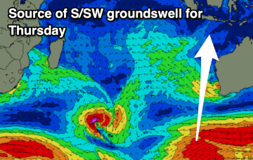
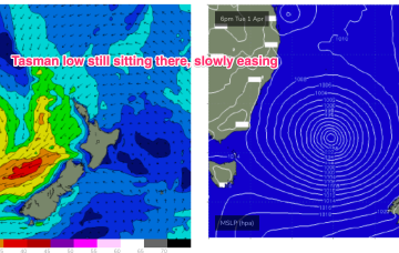
As of this morning our deep Tasman low (984hPa) is still slow moving although high pressure support has slipped in under the low with the strongest winds now aimed more at Tasmania.
As of this morning our deep Tasman low (984hPa) is still slow moving although high pressure support has slipped in under the low with the strongest winds now aimed more at Tasmania.
The current building swell will ease slowly tomorrow as winds slowly strengthen. Next week looks fun as well.
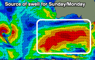
We’ll see the low meander towards the South Island for the remainder of the week, with large swells on the ease across Southern/Central NSW, much less size into the sub-tropics. A trough is sitting off the SEQLD coast directing moist SE winds along the region.
The Mid Coast looks fun into the end of the week with larger surf for the South Coast from later Sunday.
We’ll see the low meander towards the South Island for the remainder of the week, with large swells on the ease across Southern/Central NSW, much less size into the sub-tropics.
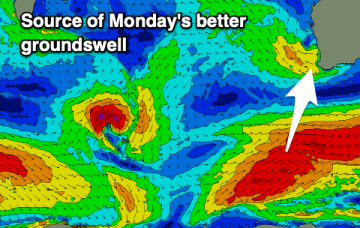
The end of the week isn't great, with improving, building swells due through the weekend thanks to a strong node of the Long Wave Trough.