Lots of action ahead as strong tropical pattern drifts southwards
Wednesday, 26 March 2025

Lots of action ahead as strong tropical pattern drifts southwards
Wednesday, 26 March 2025
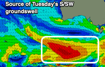
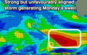
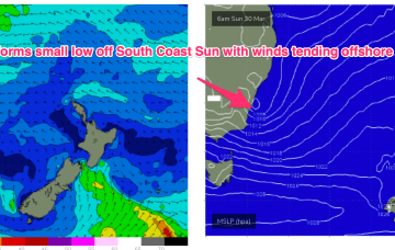
It’s likely we will see remnants of the inland monsoon low approach the SEQLD/NSW Coast during the weekend, dragging a moist NE flow down from the tropics and creating a mini black nor-easter event. We’ll see surf from this NE-E/NE infeed propagate from the sub-tropics down to temperate regions over the weekend.