Good swells and decent winds until late week
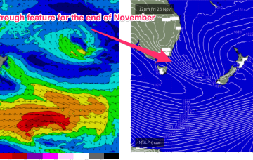
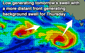
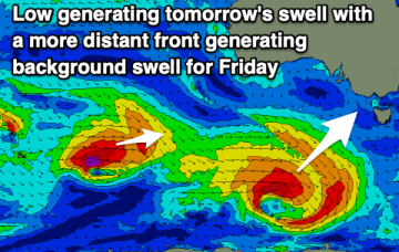
We've got plenty of fun swell due this period and with favourable winds until Friday/Saturday.
This trough is expected to exit the South Coast and form a long SSE angled fetch on Fri as it becomes cradled by a large high moving through the Bight. A pretty classic set-up.
A couple of good swell pulses over the coming days and with favourable winds, with easing, clean surf into the end of the week.
Further north from Yamba up into SEQLD, swell will be mostly generated by a broad coverage of ESE winds in the Southern Coral Sea and Northern Tasman.
Our current unstable, stormy pattern is being driven by a peanut-shaped high straddling Tasmania, and multiple troughs of low pressure, stretching from the interior of NSW, out to the Mid North Coast and South Pacific near New Zealand’s North Island.
A small window of cleaner conditions before the winds really pick up later week, generating a sizey, stormy S/SE windswell.
Clean conditions for the beaches with some good swell over the coming days ahead of a poor, windy end to the week.
Current model runs suggest the low is further north, and unlikely to exit the coast until late Sun evening or even early Mon. The fetch is now no longer aimed into the Tasmanian swell window so the swell due Sun/Mon, in effect, has been downgraded to almost nothing.
Lots of surfing days ahead with favourable winds and fun pulses of swell.
Dominant high pressure sits just East of Tasmania by Mon next week, directing a strong E’ly flow, likely enhanced by the remnants of the interior low sitting off the Central/Mid-North NSW Coast.