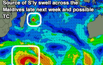
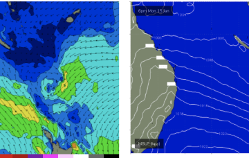
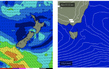
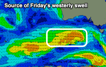
Poor weekend, options to the east early next week
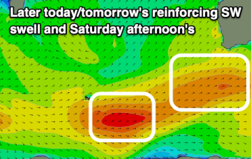
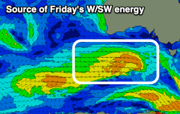
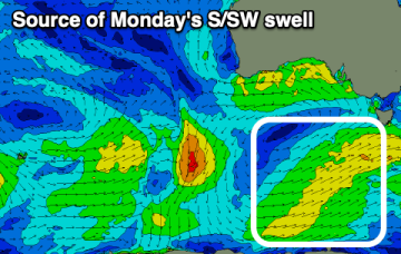
Make the most of this morning's swell and improving conditions before onshore winds kick in on the weekend. Early next week looks fun.
One final pulse of swell for Indo, then easing.
A large high SE of the South Island (1034 hPa) interacting with a broad low pressure trough in the South Pacific which will supply E’ly quadrant swell in the near term as the low pressure trough retrogrades back towards the east coast and a SE surge develops up the QLD coast.
The high pressure belt remains positioned well to the south with continuing troughiness and NE wind episodes ahead.
Small building W/SW swell tomorrow, peaking Friday with generally light winds. Poor weekend with a strong front moving through.
The South West will provide fun surf over the coming days, best out of the wind but also smaller in these spots.
The compact low near Tasmania is now skipping away to the SE with a large high SE of the South Island (1034 hPa) interacting with a broad low pressure trough in the South Pacific which will supply E’ly quadrant swell in the near term as the low pressure trough retrogrades back towards the east coast.
The coming days look fun with a mix of W/SW swells and favourable morning winds.
There's a good mix of W/SW swells due into the end of the week with workable winds. The weekend will be poor.