Plenty of swell still on the radar for South Oz
Wednesday, 18 May 2016
Plenty of swell still on the radar for South Oz
Wednesday, 18 May 2016
We’ve got more swell on the way.
We’ve got more swell on the way.
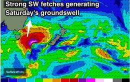
We’re still in the midst of a particularly active autumnal Southern Ocean pattern, and gale warnings are out for the coast on Thursday.
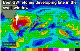
Local frontal activity is set to continue, although this time with a pair of systems moving far enough to the south to provide a small amount of energy.
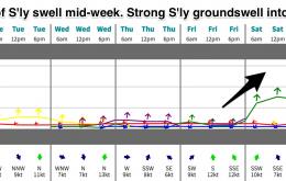
Solid pulse of S'ly swell due to peak on Saturday, with a second pulse mid-way through next week. Biggest across Northern NSW, not much for SE QLD.
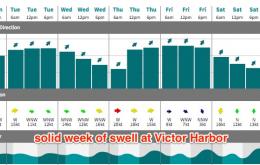
Finally breaking the zonal pattern with better S'ly pulses due Friday into Saturday and Tuesday into Wednesday.
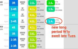
Small pulses of SW swell throughout the week, becoming large on the weekend.
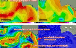
Right now we’ve got a cold front steam-rolling through the Bight; a change is expected locally this evening but it’ll clear quickly to the east, leaving mainly moderate W’ly tending light NW winds in its wake.
Relentless fronts with poor alignment. Possible increase in S'ly swell late week.
A series of small S'ly swell preceding strong pulse on the weekend. Generally light winds each morning.
We’ve got a really good, consistent pattern of active Southern Ocean fronts at the moment.