Not much in the short term; more promise for the long term

Sydney Hunter Illawarra Surf Forecast by Ben Matson (issued Friday 18th Feb)
Forecast Summary (tl;dr)
- Average start to the weekend with onshore winds
- Small building S'ly groundswell Sat PM, showing best Sun AM with light morning winds
- Another troughy pattern early next week but with minimal swell prospects
- Fun round of extended E/NE swells from mid-late next week onwards
Recap
Small weak waves over the last few days, with a mix of trade swell, NE windswell and minor S’ly swell up to 1-2ft at open beaches. Light winds early Thursday freshening NE into the afternoon, then general light winds for most of today though gusty S/SE breezes are currently pushing up the coast (currently gusting 24kts at Wattamolla).
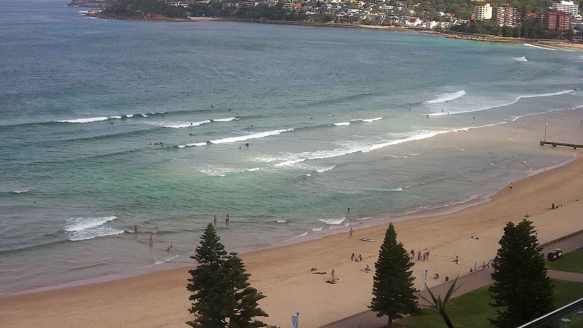
Small and average at Manly today
This weekend (Feb 19 - 20)
The southerly change pushing up Southern NSW this afternoon doesn’t have a lot of strength nor longevity in its fetch, but we do have some swell potential for the weekend thanks to a secondary S’ly groundswell, originating from the parent low that passed below Tasmania overnight.
No real quality is expected to first, perhaps 2-3ft sets of local southerly windswell at reliable south swell magnets (much smaller elsewhere) and it’s likely most coasts will be under the influence of easing S/SE winds - only a few stretches will be lucky to see an overnight easing and SW flow through the early morning (i.e. the Northern Beaches).
Fortunately, winds will ease through the day so the afternoon should see lumpy but slowly improving conditions.
Later Saturday (earlier down south) the leading edge of a better quality S’ly groundswell (from the parent low to today's S'ly change) will make landfall, and this should provide some decent 2-3ft sets across south facing beaches. If we’re very lucky, the Hunter may see a few bigger waves in the 3-4ft range though I am expecting this swell to peak overnight (its late ETA does have an inherent risk that it may not reach more northern regions before sundown). So, Saturday is a low confidence event.
Sunday morning is a better time to capitalise on this swell as we’ll see light variable winds overnight, leading to generally clean though slightly wobbly open south facing beaches. Freshening N/NE winds are expected into the afternoon so get in before lunch if you can.
Sunday’s south swell will trend slowly down through the day. Early morning should still manage slow 2-3ft sets at south facing beaches with occasional bigger sets in the Hunter around dawn.
Elsewhere, and there’ll be a trickle of residual trade swell in the water keeping open beaches just rideable for grommets and beginners.
Next week (Feb 21 onwards)
Overnight NE winds on Sunday may generate some minor windswell for Monday but there won’t be much in it. A trough will slide up the coast through the day bringing a shallow S’ly change.
A small long range S’ly groundswell may appear through the day (it’s not expected early morning in Sydney; the South Coast will see an earlier arrival though), generated by a polar low well south of Tasmania over the last few days. However I’m doubtful even the most reliable south swell magnets will pick up infrequent 2-3ft sets. And, by the time the swell arrives, the (unrelated) S’ly change will also be nosing into the coast.
So don’t get your hopes up.
Another series of fronts tracking around a polar low south of Tasmania from Sunday into Monday will generate small levels of acute S’ly swell for Tuesday afternoon and Wednesday, but this energy will be poorly aligned for our region and will probably just glance a couple of reliable, exposed swell magnets with slow 2ft sets.
Local winds look tricky under the influence of a coastal trough. Onshore are likely south from the trough’s axis, which may be in the vicinity of Sydney early Tuesday, but will probably slip southwards through the day, allowing variable conditions to concurrently spread south into the afternoon. Variable conditions are they likely on Wednesday.
Anyway, it all looks a little small and patchy for my liking. Hopefully Monday will see some kind of tweak to the model guidance.
Looking further ahead - and further north - and the models have completely wiped the prospects of a tropical cyclone in the Coral Sea this weekend. We’ll still see a developing surface trough, and it may slowly meander southwards along the SE Qld and Northern NSW coast into the start of the week, freshening E'ly winds across the northern Tasman Sea.
This pattern should produce a slow increase in E/NE trade swell for Southern NSW, starting to show around Thursday and then holding through the weekend and beyond. At this stage no major size is expected however I’m personally more in favour of smaller, sustained swell patterns than short-lived, sizeable events, as they help to spread the crowds around, and this swell direction allows a broader diversity of surfing options.
So, don’t get too hung up about the weekend’s waves (though slot in an early session on Sunday at a south swell magnet) and then get ready for an extended run of fun beaches from mid-late next week onwards. I reckon we’ll probably see an upgrade in E/NE potential next week too, centered around next weekend and the start of the following week.
See you Monday!