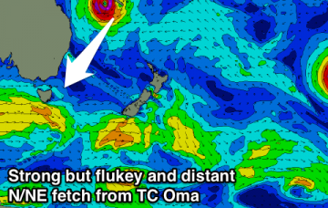
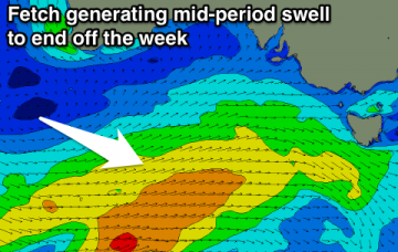
A bit of swell but average winds to end the week
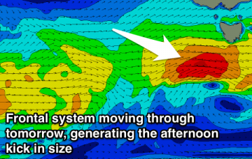
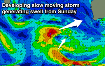
Make the most of the current conditions as winds will go onshore from tomorrow and improve later in the weekend.
On Sunday evening, the world’s leading atmospheric model (ECMWF) bucked the trend: keeping TC Oma off the SE Qld coast for a few days and then actually tracking it north, ahead of a coastal crossing mid-next week.
TC Oma's been a fascinating system to watch over the last few days, mainly because of its slow moving nature in and around the Vanuatu region. More in the Forecaster Notes.
A rare and flukey N/NE groundswell for the end of the week with a more reliable SE groundswell in the mix.
Various W/SW swells over the period with a small SE swell to end off the week.
A pesky trough will bring onshore winds as a good new swell peaks this week, with some better potential late in the weekend and early next week.
Good swell tomorrow but with generally average winds, likely cleaner into Wednesday with another swell later week.
Good increase in new swell tomorrow, easing slowly into the end of the week with good winds for protected spots a couple of mornings.
It’s hard to stay focused on the short term when there’s a major cyclone event looking for the Coral Sea. So try not to get distracted by the synoptics for the next few days.
We’re potentially looking at several phases of large swells for Southern NSW as a result. More in the Forecaster Notes.