Windy and stormy swells on the way
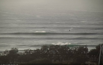
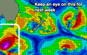
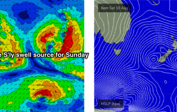
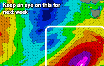
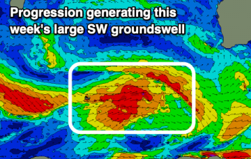
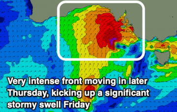
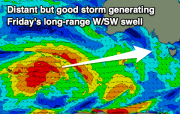
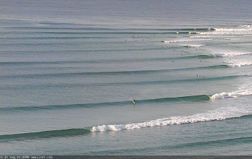
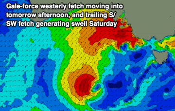
Large stormy waves developing on the Mid Coast, building a little later down South and remaining large into the weekend.
A mix of swells and winds over the coming days with tricky troughs and fronts pushing through, larger and stormy on Sunday.
The associated fronts were slightly off-kilter for our swell window, but the fetch length has been very impressive an intense polar low at the bottom of the system (just off the ice shelf) displayed a nice core of 50kt+ winds yesterday, of which the associated swell energy will arrive across Northern NSW tomorrow. More in the Forecaster Notes.
Lots of swell out of the south on the way with a few big days in the mix.
Despite the swell charts showing much smaller surf for the next few days (it’s resolving the periods well, but not the swell size), I am holding steady with the forecast. More in the Forecaster Notes.
Swells mainly from the south this period, windy and stormy at stages and great quality at other times.
A good SW groundswell this week but with generally onshore winds across the South West until it eases. Possible XXL swell for next week.
A couple of small swell pulses over the coming days with varying winds, bigger, stormy and windy later week.
Smaller, tricky swells this week though with windows for both coasts, larger but generally poor on the weekend, with a good new S/SW groundswell early next week.
Throughout SE Qld, I’ve changed my opinion on this swell and I think there’s a decent chance that that it’ll perform pretty well for the outer points, because most of the energy will have been sourced from the eastern Tasman Sea. More in the Forecaster Notes.