Coral Sea low brings mid-winter blast of surf this week
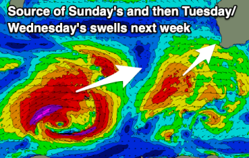
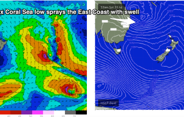
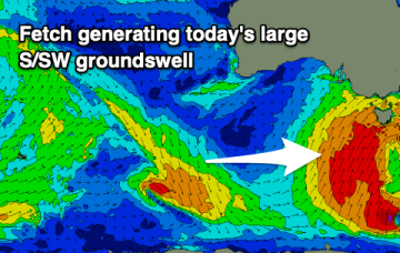
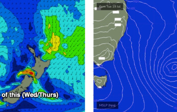
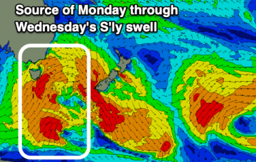
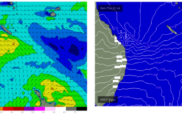
Typical winter set-up gets shunted aside by a very La Niña looking synoptic pattern this week, more reminiscent of Feb/Mar than July.
Tomorrow will be the cleanest before we see a series of strengthening lows and cold fronts pushing up into us, bringing XL swell next week with workable winds.
Surf comes from a wide variety of sources this week as a typical strong winter cold front gets shunted aside by a very La Niña looking synoptic pattern, more reminiscent of Feb/Mar than July.
Solid surf tomorrow morning but with less than ideal east winds, cleaning up slowly into the middle to end of the week with fading size. There's a tricky west swell for the Mid Saturday but check back here Wednesday for the latest.
A strong, slow moving high will dominate our swell window and local winds, favouring the exposed beaches.
No change to the weekend trend outlook, with the current south swell easing rapidly both days.
Longer term has some some ordinarily unseasonable tropical activity in the Coral Sea, which is seemingly becoming the norm.
Nothing to work around on the weekend, with windy south swells into early-mid next week.
We've got an upgrade for early next week with the strong frontal progression forming south of us Sunday due to have some strength.