Make the most of today and tomorrow
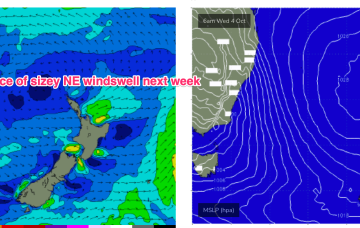
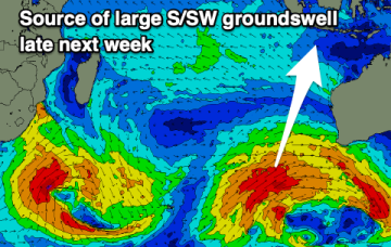
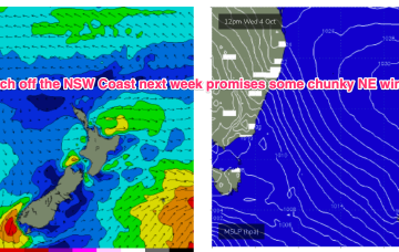
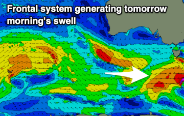
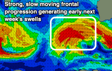
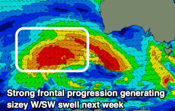
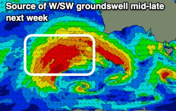
The South Coast is the pick of the coming days before things deteriorate into Sunday. A large W/SW and S/SW groundswell are due next week but with mostly poor winds.
We’ve got a strong, expansive front passing through the Tasman at present will which supply pulses of S swell over the coming days. High pressure over NSW is moving NE into the Tasman, with a N’ly flow developing. That N'ly flow will really intensify next week with some juicy NE windswell resulting.
Favourable winds and fun levels of swell are worth making the most of. Mid-late next week looks larger but with poor winds.
A good swell to end off the week ahead of a larger, consistent swell next week.
High cells are now tending to move NE as they enter the Tasman, with just enough tradewind flow through the Coral Sea to maintain a small drumbeat of surf in CQ, favouring open breaks on the Burnett Coast.
Small, combination swells and some light wind periods pad out the rest of the week with a more entrenched N’ly episode next week with solid NE swell expected.
Tomorrow looks fun while Friday will become bigger but choppy.
Make the most of today before conditions deteriorate into the end of the week. Early next week will be big and stormy.
High cells are now tending to move NE as they enter the Tasman, bringing N’ly episodes which were rare through our triple La Niña but are becoming common as we enter El Niño proper. Small, combination swells and some light wind periods pad out the rest of the week with a more entrenched N’ly episode next week.
Varying winds are due through this period along with some fun swell that will mainly favour the South Coast. The Mid will see more action next week.