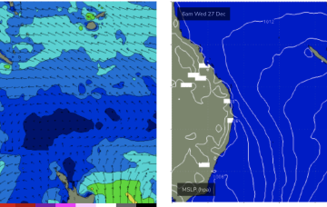
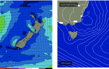
Some small windows of lighter winds look likely
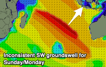
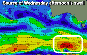
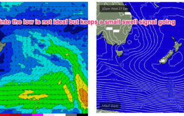
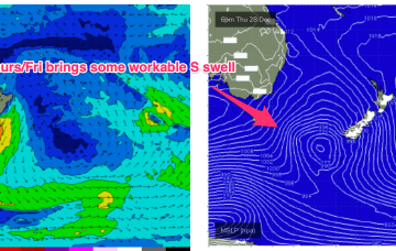
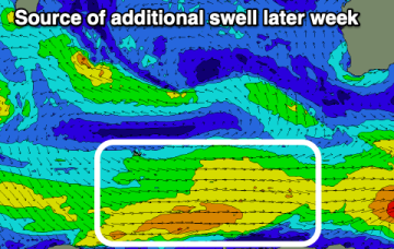
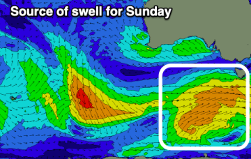
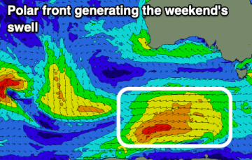
There's plenty of swell due over the coming days and winds look to be lighter at periods. It won't be perfect though surfable.
The onshore winds will continue to create poor conditions this period, with a window for early Saturday morning. Sunday will become sizey.
Fun swell building today, with a secondary pulse for Sunday/Monday.
No change to the outlook, very weak pressure gradients in the Coral Sea and an absence of swell generating winds extends through the last week of 2023 and right through the first week of 2024.
The infeed into the low is focussed on Far Southern NSW and Tasmania before the low moves into the Tasman and drifts SE. We’ll see plenty of E quadrant swell off the infeed. Frontal systems following this troughy pattern should supply S swell of moderate size late in the week and over NYE and New Years Day.
Good sized surf is due over the coming period with workable winds.
For our sub-tropical region the main swell source will be a proximate N’ly fetch extending up to water adjacent to the CQ coast and holding a workable NE windswell.
We’ll see some small E quadrant swell off the infeed, with a North-South gradient for size but even open the Far South Coast the size will be modest and onshore winds will keep quality low. Frontal systems following this troughy pattern should supply some better quality S swell of modest size late in the week and over NYE and New Years Day.
Make the most of this morning's waves and then try again later week.
There'll be hardly any letup in the onshore winds which will create poor surfing conditions.