Tricky period ahead, Sunday the pick

Sydney, Hunter and Illawarra Surf Forecast by Ben Matson (issued Wednesday 1st April)
Best Days: Late Friday: keep an eye out for a very late pulse of new S'ly swell, and a possible easing of winds. Sun: improving conditions with a fun short range swell (and a poss late E/NE pulse). Mon: smaller but clean options with easing swells. Wed onwards: large surf on the cards with a possible ECL.
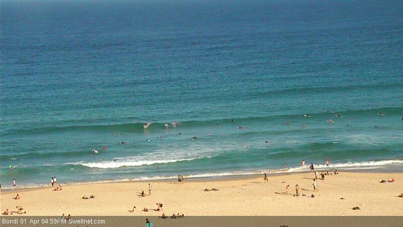
Recap: Small waves and average conditions. We’ve actually seen a small increase this afternoon at both south facing beaches (from a small, very inconsistent S’ly groundswell, see image below) and regular open beaches (from a small trade swell) but it’s certainly not been worth any major effort, wave heights have only been 1-2ft max, and very slow.
This week (Apr 2 - 3)
There’s been a couple of notable alterations in the model data since Monday.
First up: Thursday's southerly change has been stalled, and downgraded in strength. So, freshening N/NE winds will prevail for much of the day, possibly generating some small windswell but in general it won’t be worth getting excited about. A small level of trade swell will be in the water but probably no more than 1-2ft at open beaches. Keep your expectations low.
The southerly change will arrive across the South Coast late afternoon and should reach Sydney overnight. However with regional wind strengths expected to be a little lighter, we won’t see much windswell from it on Easter Friday: perhaps 2ft to maybe 3ft of low quality surf at south facing beaches (smaller elsewhere), with bumpy conditions in general under a moderate to fresh S/SE airstream (low chance for a few selected areas to see light W/SW winds at dawn, and consequently lumpy/semi-clean conditions).
BUT! This also harbours some good news, because along with slowly easing winds throughout Friday, a new south swell originally pegged for Saturday morning has been brought forward to late Friday (early-mid afternoon on the South Coast, late afternoon in Sydney/Hunter regions). And this should light up the coast with some OK surf just before dark.
The responsible low off Tasmania’s East Coast has also been slightly downgraded in the latest runs but core wind speeds look pretty impressive and south facing beaches should pick up some solid 4ft+ sets in the few hours before sunset (expect much smaller surf at beaches not open to the south).
Local winds still look a little tricky by this time but they should be easing so we should see a general improvement in conditions. Either way, keep an eye on the Bondi surfcam for signs of the new southerly groundswell (I’ll update in the comments below too).
This weekend (Apr 4 - 5)
Local winds still look to be an issue for the first half of the weekend, although swell won’t be a problem.
A deepening trough along the Northern NSW and a strengthening ridge to the south will freshen SE winds about most areas on Saturday. So, we’ll see 3-4ft of short range local swell in tandem with an initial 3-5ft S’ly swell early morning, that’s expected to ease rapidly during the day (this south swell will probably have peaked overnight Friday, originating from the low east of Tasmania).
It looks like the surface trough’s axis will be just north of the Hunter, so if you’re planning an Easter road trip to the Mid North Coast conditions should be much better there - but most southern NSW coasts look to be wet and windy on Saturday.
The south swell will be almost gone by Sunday, and we’ll be left with a punchy but easing short range SE swell from the local ridge (3-4ft most open beaches). However, conditions should be on the improve as the trough consolidates into a moderate Tasman Low - we’re likely to see winds tend S’ly then SW throughout the morning (earlier down south than in the Sydney/Hunter region). In fact a more-rapid-than-forecast improvement is always possible under these scenarios, and short range swells are usually quite peaky and well suited to the beach breaks. So Sunday could end up being very good all day.
Also on the cards - albeit as an outside possibility - is a brief pulse of E/NE swell late Sunday from a strong NE infeed into the trough on Saturday. However, the models are a little flaky on this situation right now so this will require further revelation in the coming days.
Nevertheless, Sunday has plenty of potential for some decent waves. I’ll update these thoughts on Friday.
Next week (Apr 6 onwards)
This Tasman Low now looks like it won’t be much of a swell producer for us - we’ll see a few small sources of SE and E/NE swell but the latest models have whisked it quickly SE, which has massively reduced confidence levels. So, expect easing swells through Monday.
There'll be some small trade swell in the mix too on Monday, but at this stage it's too hard to estimate how much size we'll see (2ft to maybe 3ft of inconsistent surf seems a reasonable figure for now). Winds will be W/NW so conditions should be nice and clean.
However the good news is that in the wake of the departing low, the atmosphere is expected to remain quite unstable - and this is prime breeding territory for another low to develop. And the models are indeed suggesting that we’ll see an upper trough trigger a low - this one more likely to be an East Coast Low - around Tuesday or Wednesday of next week, which suggests large surf possibilities from Wednesday thru' Friday next week.
This is all still quite some time away, and given the variations in model output over the last few days we really need to give it some more time to firm up possibilities. But right now the second half of next week is certainly on target for a very significant swell event. More on this in Friday’s notes.
Comments
Ohoi there! The model for Ulladulla is saying ssw swell at 200 degrees whereas sydney area is more direct south swell for friday/saturday. Do you reckon south coast will pick up much of this swell?
Im ok with the wind and rain but that swell direction is a bit over the top haha!
edit: models updated, looking better now. phewww!
Just got word that the expected S'ly groundswell has hit the South Coast, and it's pumping at a few spots (winds are SW south of Jervis Bay) with wave heights in the 3-5ft range. Should be into Sydney mid-late afternoon.
Local winds are easing back as expected too - Little Bay's down 7kts since dawn (average wind speed) and North Head is down 5kts. Should be quite manageable by mid-late arvo.
swell filled in nicely in the gong around 90 minutes ago. winds been sw all day too
Unreal.. Thanks for the observations!