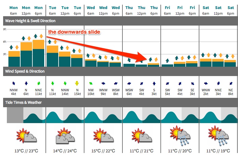
Steadily easing south swell all week

Sydney, Hunter and Illawarra Surf Forecast by Ben Matson (issued Monday 26th May)
Best Days: Tues: strong, easing south swell - get in early for the most size and best winds. Wed: small clean leftovers with freshening offshore winds. Late Fri/Sat: small distant south swell.
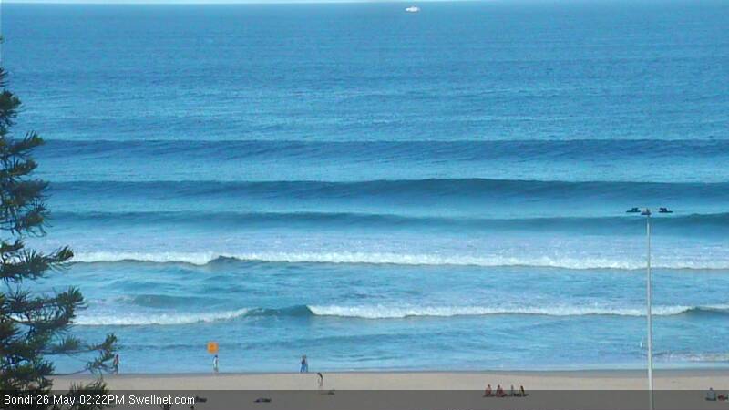
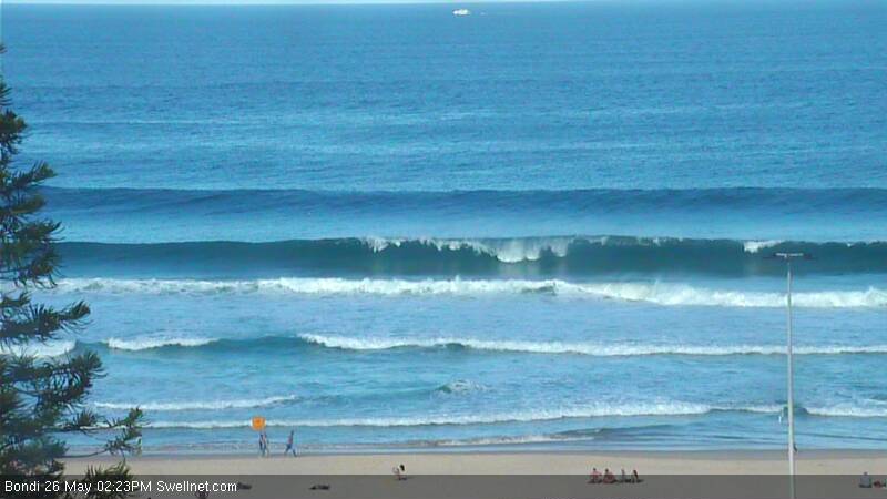
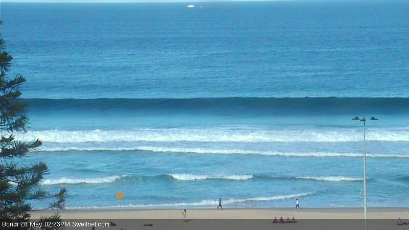
Recap: Small fun combo of south and east swells on Saturday, with a strong S’ly groundswell building throughout Sunday, with large waves in the Hunter. Clean both days with mainly offshore winds. Large S’ly swell building across the coast at the moment (5-6ft sets observed on the Bondi surfcam, see below), with early light tending NE and freshening.
This week (May 27-30)
You’ll have to make the most of the current south swell as it’s a one way ticket to mediocrity this week. Tuesday morning should still have plenty of waves in the 4-5ft range at south facing beaches (smaller elsewhere but bigger in the Hunter), however surf size will ease throughout the day and this trend will continue through Wednesday and Thursday.
Local winds will freshen from the north on Tuesday and become quite gusty, so you’ll have to tuck into a sheltered northern corner for the best waves (early morning should see more NW in the wind direction, albeit briefly). These winds may whip up a small NE windswell for Wednesday but I’ll be very surprised if there’s more than a foot or two tops at exposed NE facing beaches. There should be some small southerly swell on offer though and exposed beachies could be worth an early paddle before it drops even more.
Wednesday’s winds will swing gusty W’ly in the wake of a vigorous cold front, however we’re not going to see any swell from this system as the latest model guidance haas actually tracked the front up over the mainland (rather than exiting eastern Bass Strait, as was previously suggested in Friday's runs).
Thursday’s looking at seeing mainly small residual swells across the region with light variable winds possibly swinging southerly associated with a shallow change - but minimal surf prospects. However the Far South Coast may pick up some small late lines out of the south, originating from a distant groundswell that’s being generated today off the ice shelf. A polar low of only moderate strength is currently forming well south of the Tasman Sea, and a broad S/SW fetch is expected to push up into the swell window on Tuesday, eventually merging with the tail end of the mid-latitude front expected to sweep across the south-eastern states on Wednesday.
This system will ultimately track into the New Zealand region by Thursday, however it will have spent at least a day or two in our swell window, and will consequently generate a small southerly swell that’s likely to reach the Far South Coast late Thursday and should be into Sydney sometime during Friday morning. At this stage I’m not holding out much hope of anything above very occasional 2ft+ sets at south facing beaches (with long waits between ‘em, and bugger all elsewhere) but this could otherwise be the only source of new swell throughout the forecast period.
This weekend (May 31 - June 1)
Friday’s small south swell will probably linger into Saturday before easing into Sunday. At this stage Saturday’s winds are looking good (mainly light and variable) however we’ve got nor’easters on the cards for Sunday with diminishing energy. There is a chance that a trough forming off the coast over the weekend (which will ultimately be responsible for Sunday’s nor’easters) could be upgraded in the coming days - with view to providing us with a punchy local E/NE swell - but that’s just me being wildly optimistic in the face of a bleak synoptic chart. So for now keep your weekend expectations low and hope for a massive about-face in the model department!
Long term (June 2 onwards)
A couple of small systems to keep an eye on for the longer term - a small trough off the NW coast of New Zealand this weekend has potential for a small to moderate east swell early next week, the weekend’s trough off the NSW coast could also deliver some E/NE or NE swell around the same time, and a series of migratory polar lows could supply intermittent long range southerly groundswell throughout much of the week. But these are all 'possible' scenarios, none of which are very promising at this early stage. Check back on Wednesday for an update.