Strong S swell on the build
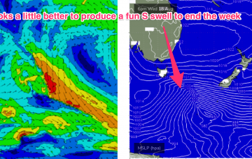
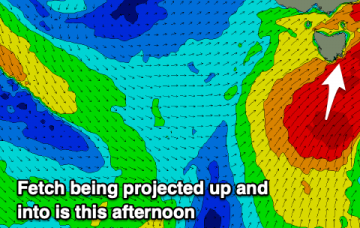
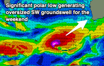
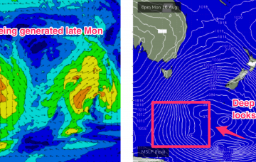
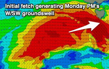
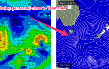
Todays passage of a polar low with a favourably angled SSW fetch now slingshotting into Tasmanian latitudes is generating a solid S swell building into this evening.
Gales exiting Bass Strait today will see a first pulse of weaker refracted S swell later tomorrow but the real juice is being generated by a deeper fetch of severe gales tracking from 55S up to 40S, into the Tasman sea through today and early tomorrow.
Large surf is expected across the South Arm from now through until tomorrow morning, cleaning up and easing from Wednesday.
Mixed conditions this period with light winds over the coming mornings before shifting onshore in the lead up to an oversized SW groundswell.
Gales exiting Bass Strait today will see a first pulse of weaker refracted S swell early tomorrow but the real juice is being generated by a deeper fetch of severe gales tracking from 55S up to 40S, into the Tasman sea through today and early tomorrow.
Favourable winds and lots of surf for the South Coast over the coming period, less so for the Mid until early next week.
Today's large mix of building swells will ease through tomorrow with less than ideal winds, cleaner Wednesday but much smaller. There are options for the beaches late week with a new, inconsistent westerly groundswell.
Eastern Tasmania Surf Forecast by Steve Shearer (issued Fri 13 August)
Features of the Forecast (tl;dr)
Recap
Small amounts of NE windswell in the 1-2ft range provided some just rideable surf Thursday. Swell from this source has eased back but with a few tiny waves available at NE facing beaches.
Lots of surfing options over the coming days with varying winds and strong swells.
There's been a local improvement to conditions on the weekend and early next week looks good until onshore winds and fronts come back late next week.