Workable period before things go quiet
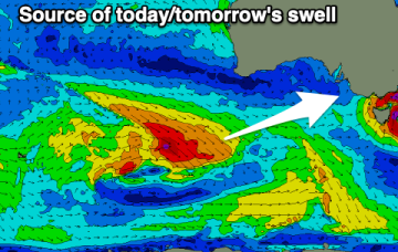
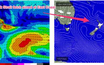
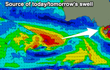
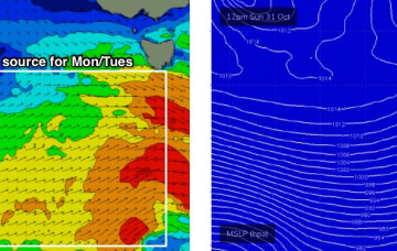
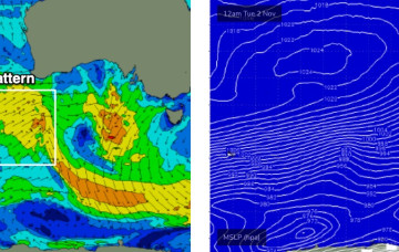
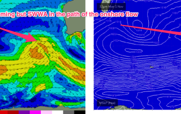
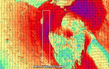
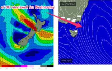
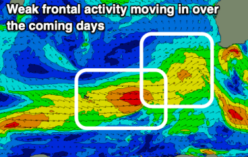
Weak fronts but workable swells over this coming period, worth making the most of before things go quiet next week.
A large (1025 hPa) high pressure system is currently drifting over Central NSW into the Tasman sea and this high pressure cell is expected to track SE, strengthen and become slow moving as it meanders near the South Island for most of this week. That creates a summer-style synoptic pattern, with SE/ESE Tradewinds through the sub-tropics and a N’ly flow through temperate NSW.
Fun windows of waves for both coasts this period, with the Mid Coast being the target later week.
A low pressure system developing north of New Zealand’s North Island drifts south to be over the North Island Wed, and while that blocks most of the fetch from generating swell for the East Coast, it does shoot out a fetch through Cook Strait Wed/Thurs which looks like a tidy source of ESE swell for the region Fri/Sat.
Winds will generally favour the beaches over the coming period with fun pulses of moderate sized + swells.
The first half of next week still looks fun.
The first half of next week looks very good, for Victor at least.
Winds will be poor though, and poor through to the middle of the week as the position of the long wave trough and a mid Indian Ocean high direct onshore winds into WA, with a series of rolling disturbances caused my cold fronts being pushed around a polar low slow moving between 90-100E.
It’s gonna take quite a bit of effort to clean up conditions from today’s blow.
No change to the headline feature: another robust low forming in a trough line East of Tasmania. It does seem to be running early, with gales to storm force winds now occurring out of Bass Strait through the early afternoon and severe gales expected to form adjacent to the East Coast overnight.